<p><br></p><p style="text-align: center;"><img width="764" class="txc-image" style="clear: none; float: none;" src="https://t1.daumcdn.net/cfile/blog/252E42395546C59235" border="0" vspace="1" hspace="1" data-filename="SAM_0101.jpg" exif="{}" actualwidth="764" id="A_252E42395546C59235C3BD"/></p><p><br></p><!--StartFragment--><p class="0" style="font-size: 12pt; font-weight: bold; margin-left: 4em; mso-pagination: none; mso-padding-alt: 0pt 0pt 0pt 0pt;"><span style="color: rgb(9, 0, 255); letter-spacing: 0pt; font-family: 휴먼둥근헤드라인; font-size: 12pt; font-weight: bold; mso-ascii-font-family: 휴먼둥근헤드라인; mso-font-width: 100%; mso-text-raise: 0pt;">(</span><span style="color: rgb(9, 0, 255); font-size: 12pt; font-weight: bold; mso-fareast-font-family: 휴먼둥근헤드라인;">전북부안 위도 섬산행</span><span style="color: rgb(9, 0, 255); letter-spacing: 0pt; font-family: 휴먼둥근헤드라인; font-size: 12pt; font-weight: bold; mso-ascii-font-family: 휴먼둥근헤드라인; mso-font-width: 100%; mso-text-raise: 0pt;">) </span><span style="color: rgb(9, 0, 255); font-size: 12pt; font-weight: bold; mso-fareast-font-family: 휴먼둥근헤드라인;">망금봉 도제봉 망월봉 파장봉 등대</span></p><p class="0" style="font-size: 12pt; font-weight: bold; margin-left: 4em; mso-pagination: none; mso-padding-alt: 0pt 0pt 0pt 0pt;"><span style="font-family: 함초롬바탕; font-size: 12pt; font-weight: bold;"><span style="color: rgb(9, 0, 255);"> </span><!--[if !supportEmptyParas]--><span style="color: rgb(9, 0, 255);">&nbsp;</span><!--[endif]--><span style="color: rgb(9, 0, 255);"> </span></span></p><p class="0" style="font-size: 12pt; font-weight: bold; margin-left: 4em; mso-pagination: none; mso-padding-alt: 0pt 0pt 0pt 0pt;"><span style="color: rgb(9, 0, 255); letter-spacing: 0pt; font-size: 12pt; font-weight: bold; mso-font-width: 100%; mso-text-raise: 0pt; mso-fareast-font-family: 함초롬바탕;">▣ </span><span style="color: rgb(9, 0, 255); letter-spacing: 0pt; font-family: 함초롬바탕; font-size: 12pt; font-weight: bold; mso-font-width: 100%; mso-text-raise: 0pt;">2015. 05. 03. </span><span style="color: rgb(9, 0, 255); font-size: 12pt; font-weight: bold; mso-fareast-font-family: 함초롬바탕;">일</span><span style="color: rgb(9, 0, 255); letter-spacing: 0pt; font-family: 함초롬바탕; font-size: 12pt; font-weight: bold; mso-font-width: 100%; mso-text-raise: 0pt;">. 13~22</span><span style="color: rgb(9, 0, 255); letter-spacing: 0pt; font-size: 12pt; font-weight: bold; mso-font-width: 100%; mso-text-raise: 0pt; mso-fareast-font-family: 함초롬바탕;">℃</span><span style="color: rgb(9, 0, 255); letter-spacing: 0pt; font-family: 함초롬바탕; font-size: 12pt; font-weight: bold; mso-font-width: 100%; mso-text-raise: 0pt;">. “</span><span style="color: rgb(9, 0, 255); font-size: 12pt; font-weight: bold; mso-fareast-font-family: 함초롬바탕;">비</span><span style="color: rgb(9, 0, 255); letter-spacing: 0pt; font-family: 함초롬바탕; font-size: 12pt; font-weight: bold; mso-font-width: 100%; mso-text-raise: 0pt;">”</span><span style="color: rgb(9, 0, 255); font-size: 12pt; font-weight: bold; mso-fareast-font-family: 함초롬바탕;">예보에도 비없이 진한 안개와 구름</span></p><p class="0" style="letter-spacing: 0pt; font-size: 12pt; font-weight: bold; margin-left: 4em; mso-pagination: none; mso-padding-alt: 0pt 0pt 0pt 0pt; mso-font-width: 100%; mso-text-raise: 0pt;"><span style="color: rgb(9, 0, 255); font-family: 함초롬바탕; font-size: 12pt; font-weight: bold;">&nbsp;&nbsp;</span><span style="color: rgb(9, 0, 255); font-size: 12pt; font-weight: bold; mso-fareast-font-family: 함초롬바탕;">&nbsp;&nbsp;&nbsp;&nbsp;</span><span style="font-family: 함초롬바탕; font-size: 12pt; font-weight: bold;"><span style="color: rgb(9, 0, 255);">&nbsp;</span><!--[endif]--><span style="color: rgb(9, 0, 255);">&nbsp; </span></span></p><p class="0" style="letter-spacing: 0pt; font-size: 12pt; font-weight: bold; margin-left: 4em; mso-pagination: none; mso-padding-alt: 0pt 0pt 0pt 0pt; mso-font-width: 100%; mso-text-raise: 0pt;"><span style="color: rgb(9, 0, 255); letter-spacing: 0pt; font-size: 12pt; font-weight: bold; mso-font-width: 100%; mso-text-raise: 0pt; mso-fareast-font-family: 함초롬바탕;">▣ </span><span style="color: rgb(9, 0, 255); font-size: 12pt; font-weight: bold; mso-fareast-font-family: 함초롬바탕;">총거리 </span><span style="color: rgb(9, 0, 255); letter-spacing: 0pt; font-family: 함초롬바탕; font-size: 12pt; font-weight: bold; mso-font-width: 100%; mso-text-raise: 0pt;">: 11.9km (</span><span style="color: rgb(9, 0, 255); font-size: 12pt; font-weight: bold; mso-fareast-font-family: 함초롬바탕;">실행거리</span><span style="color: rgb(9, 0, 255); letter-spacing: 0pt; font-family: 함초롬바탕; font-size: 12pt; font-weight: bold; mso-font-width: 100%; mso-text-raise: 0pt;">)</span></p><p class="0" style="font-size: 12pt; font-weight: bold; margin-left: 4em; mso-pagination: none; mso-padding-alt: 0pt 0pt 0pt 0pt;"><span style="color: rgb(9, 0, 255); font-family: 함초롬바탕; font-size: 12pt; font-weight: bold;"> </span><span style="color: rgb(9, 0, 255); letter-spacing: 0pt; font-family: 함초롬바탕; font-size: 12pt; font-weight: bold; mso-font-width: 100%; mso-text-raise: 0pt;">&nbsp;&nbsp; - </span><span style="color: rgb(9, 0, 255); font-size: 12pt; font-weight: bold; mso-fareast-font-family: 함초롬바탕;">지도상 도제봉 및 위도방파제 등대 왕복 포함</span></p><p class="0" style="letter-spacing: 0pt; font-size: 12pt; font-weight: bold; margin-left: 4em; mso-pagination: none; mso-padding-alt: 0pt 0pt 0pt 0pt; mso-font-width: 100%; mso-text-raise: 0pt;"><span style="color: rgb(9, 0, 255); font-family: 함초롬바탕; font-size: 12pt; font-weight: bold;"> </span><span style="color: rgb(9, 0, 255); letter-spacing: 0pt; font-family: 함초롬바탕; font-size: 12pt; font-weight: bold; mso-font-width: 100%; mso-text-raise: 0pt;">&nbsp;&nbsp; - orux </span><span style="color: rgb(9, 0, 255); font-size: 12pt; font-weight: bold; mso-fareast-font-family: 함초롬바탕;">도상거리 </span><span style="color: rgb(9, 0, 255); letter-spacing: 0pt; font-family: 함초롬바탕; font-size: 12pt; font-weight: bold; mso-font-width: 100%; mso-text-raise: 0pt;">: 10.84km</span></p><p class="0" style="font-size: 12pt; font-weight: bold; margin-left: 4em; mso-pagination: none; mso-padding-alt: 0pt 0pt 0pt 0pt;"><span style="font-family: 함초롬바탕; font-size: 12pt; font-weight: bold;"><span style="color: rgb(9, 0, 255);"> </span><!--[if !supportEmptyParas]--><span style="color: rgb(9, 0, 255);">&nbsp;</span><!--[endif]--><span style="color: rgb(9, 0, 255);"> </span></span></p><p class="0" style="letter-spacing: 0pt; font-size: 12pt; font-weight: bold; margin-left: 4em; mso-pagination: none; mso-padding-alt: 0pt 0pt 0pt 0pt; mso-font-width: 100%; mso-text-raise: 0pt;"><span style="color: rgb(9, 0, 255); letter-spacing: 0pt; font-size: 12pt; font-weight: bold; mso-font-width: 100%; mso-text-raise: 0pt; mso-fareast-font-family: 함초롬바탕;">▣ </span><span style="color: rgb(9, 0, 255); font-size: 12pt; font-weight: bold; mso-fareast-font-family: 함초롬바탕;">총시간 </span><span style="color: rgb(9, 0, 255); letter-spacing: 0pt; font-family: 함초롬바탕; font-size: 12pt; font-weight: bold; mso-font-width: 100%; mso-text-raise: 0pt;">: 4</span><span style="color: rgb(9, 0, 255); font-size: 12pt; font-weight: bold; mso-fareast-font-family: 함초롬바탕;">시간</span><span style="color: rgb(9, 0, 255); letter-spacing: 0pt; font-family: 함초롬바탕; font-size: 12pt; font-weight: bold; mso-font-width: 100%; mso-text-raise: 0pt;">25</span><span style="color: rgb(9, 0, 255); font-size: 12pt; font-weight: bold; mso-fareast-font-family: 함초롬바탕;">분 </span><span style="color: rgb(9, 0, 255); letter-spacing: 0pt; font-family: 함초롬바탕; font-size: 12pt; font-weight: bold; mso-font-width: 100%; mso-text-raise: 0pt;">(10:41~15:06)</span></p><p class="0" style="letter-spacing: 0pt; font-size: 12pt; font-weight: bold; margin-left: 4em; mso-pagination: none; mso-padding-alt: 0pt 0pt 0pt 0pt; mso-font-width: 100%; mso-text-raise: 0pt;"><span style="color: rgb(9, 0, 255); font-family: 함초롬바탕; font-size: 12pt; font-weight: bold;"> </span><span style="color: rgb(9, 0, 255); letter-spacing: 0pt; font-family: 함초롬바탕; font-size: 12pt; font-weight: bold; mso-font-width: 100%; mso-text-raise: 0pt;">&nbsp;&nbsp; - </span><span style="color: rgb(9, 0, 255); font-size: 12pt; font-weight: bold; mso-fareast-font-family: 함초롬바탕;">중식</span><span style="color: rgb(9, 0, 255); letter-spacing: 0pt; font-family: 함초롬바탕; font-size: 12pt; font-weight: bold; mso-font-width: 100%; mso-text-raise: 0pt;">, </span><span style="color: rgb(9, 0, 255); font-size: 12pt; font-weight: bold; mso-fareast-font-family: 함초롬바탕;">조망과 표지부착 등 비이동 </span><span style="color: rgb(9, 0, 255); letter-spacing: 0pt; font-family: 함초롬바탕; font-size: 12pt; font-weight: bold; mso-font-width: 100%; mso-text-raise: 0pt;">45</span><span style="color: rgb(9, 0, 255); font-size: 12pt; font-weight: bold; mso-fareast-font-family: 함초롬바탕;">분포함 </span><span style="color: rgb(9, 0, 255); letter-spacing: 0pt; font-family: 함초롬바탕; font-size: 12pt; font-weight: bold; mso-font-width: 100%; mso-text-raise: 0pt;">(</span><span style="color: rgb(9, 0, 255); font-size: 12pt; font-weight: bold; mso-fareast-font-family: 함초롬바탕;">순산행 </span><span style="color: rgb(9, 0, 255); letter-spacing: 0pt; font-family: 함초롬바탕; font-size: 12pt; font-weight: bold; mso-font-width: 100%; mso-text-raise: 0pt;">3</span><span style="color: rgb(9, 0, 255); font-size: 12pt; font-weight: bold; mso-fareast-font-family: 함초롬바탕;">시간</span><span style="color: rgb(9, 0, 255); letter-spacing: 0pt; font-family: 함초롬바탕; font-size: 12pt; font-weight: bold; mso-font-width: 100%; mso-text-raise: 0pt;">40</span><span style="color: rgb(9, 0, 255); font-size: 12pt; font-weight: bold; mso-fareast-font-family: 함초롬바탕;">분</span><span style="color: rgb(9, 0, 255); letter-spacing: 0pt; font-family: 함초롬바탕; font-size: 12pt; font-weight: bold; mso-font-width: 100%; mso-text-raise: 0pt;">)</span></p><p class="0" style="font-size: 12pt; font-weight: bold; margin-left: 4em; mso-pagination: none; mso-padding-alt: 0pt 0pt 0pt 0pt;"><span style="font-family: 함초롬바탕; font-size: 12pt; font-weight: bold;"><span style="color: rgb(9, 0, 255);"> </span><!--[if !supportEmptyParas]--><span style="color: rgb(9, 0, 255);">&nbsp;</span><!--[endif]--><span style="color: rgb(9, 0, 255);"> </span></span></p><p class="0" style="font-size: 12pt; font-weight: bold; margin-left: 4em; mso-pagination: none; mso-padding-alt: 0pt 0pt 0pt 0pt;"><span style="color: rgb(9, 0, 255); letter-spacing: 0pt; font-size: 12pt; font-weight: bold; mso-font-width: 100%; mso-text-raise: 0pt; mso-fareast-font-family: 함초롬바탕;">▣ </span><span style="color: rgb(9, 0, 255); font-size: 12pt; font-weight: bold; mso-fareast-font-family: 함초롬바탕;">주요지점간 거리와 시간</span></p><p class="0" style="font-size: 12pt; font-weight: bold; margin-left: 4em; mso-pagination: none; mso-padding-alt: 0pt 0pt 0pt 0pt;"><span style="font-family: 함초롬바탕; font-size: 12pt; font-weight: bold;"> <!--[if !supportEmptyParas]-->&nbsp;<!--[endif]--> </span></p><p class="0" style="font-size: 12pt; font-weight: bold; margin-left: 4em; mso-pagination: none; mso-padding-alt: 0pt 0pt 0pt 0pt;"><span style="letter-spacing: 0pt; font-family: 함초롬바탕; font-size: 12pt; font-weight: bold; mso-font-width: 100%; mso-text-raise: 0pt;">10:41 </span><span style="color: rgb(108, 34, 86); font-size: 12pt; font-weight: bold; mso-fareast-font-family: 함초롬바탕;">깊은금</span><span style="font-family: 함초롬바탕; font-size: 12pt; font-weight: bold;"> </span><span style="letter-spacing: 0pt; font-family: 함초롬바탕; font-size: 12pt; font-weight: bold; mso-font-width: 100%; mso-text-raise: 0pt;">(</span><span style="font-size: 12pt; font-weight: bold; mso-fareast-font-family: 함초롬바탕;">마을표석</span><span style="letter-spacing: 0pt; font-family: 함초롬바탕; font-size: 12pt; font-weight: bold; mso-font-width: 100%; mso-text-raise: 0pt;">/</span><span style="font-size: 12pt; font-weight: bold; mso-fareast-font-family: 함초롬바탕;">내원암입구 표지</span><span style="letter-spacing: 0pt; font-family: 함초롬바탕; font-size: 12pt; font-weight: bold; mso-font-width: 100%; mso-text-raise: 0pt;">) </span><span style="font-size: 12pt; font-weight: bold; mso-fareast-font-family: 함초롬바탕;">산행시작</span></p><p class="0" style="color: rgb(108, 34, 86); letter-spacing: 0pt; font-size: 12pt; font-weight: bold; margin-left: 4em; mso-pagination: none; mso-padding-alt: 0pt 0pt 0pt 0pt; mso-font-width: 100%; mso-text-raise: 0pt;"><span style="letter-spacing: 0pt; font-family: 함초롬바탕; font-size: 12pt; font-weight: bold; mso-font-width: 100%; mso-text-raise: 0pt;">10:55~10:58(3) </span><span style="color: rgb(108, 34, 86); font-size: 12pt; font-weight: bold; mso-fareast-font-family: 함초롬바탕;">내원암</span><span style="font-family: 함초롬바탕; font-size: 12pt; font-weight: bold;"> </span><span style="font-size: 12pt; font-weight: bold; mso-fareast-font-family: 함초롬바탕;">관람 및 참배&nbsp;&nbsp;&nbsp;&nbsp;&nbsp;&nbsp;&nbsp;&nbsp;&nbsp;&nbsp; &nbsp; </span><u style="text-underline: #000000 single;"><span style="color: rgb(108, 34, 86); letter-spacing: 0pt; font-family: 함초롬바탕; font-size: 12pt; font-weight: bold; mso-font-width: 100%; mso-text-raise: 0pt;">1.1km, 14</span></u><u style="text-underline: #000000 single;"><span style="color: rgb(108, 34, 86); font-size: 12pt; font-weight: bold; mso-fareast-font-family: 함초롬바탕;">분 </span></u><u style="text-underline: #000000 single;"><span style="color: rgb(108, 34, 86); letter-spacing: 0pt; font-family: 함초롬바탕; font-size: 12pt; font-weight: bold; mso-font-width: 100%; mso-text-raise: 0pt;">(</span></u><u style="text-underline: #000000 single;"><span style="color: rgb(108, 34, 86); font-size: 12pt; font-weight: bold; mso-fareast-font-family: 함초롬바탕;">누계</span></u><u style="text-underline: #000000 single;"><span style="color: rgb(108, 34, 86); letter-spacing: 0pt; font-family: 함초롬바탕; font-size: 12pt; font-weight: bold; mso-font-width: 100%; mso-text-raise: 0pt;">/17)</span></u></p><p class="0" style="font-size: 12pt; font-weight: bold; margin-left: 4em; mso-pagination: none; mso-padding-alt: 0pt 0pt 0pt 0pt;"><span style="letter-spacing: 0pt; font-family: 함초롬바탕; font-size: 12pt; font-weight: bold; mso-font-width: 100%; mso-text-raise: 0pt;">11:12 </span><span style="font-size: 12pt; font-weight: bold; mso-fareast-font-family: 함초롬바탕;">전막리 주능선 합류</span><span style="letter-spacing: 0pt; font-family: 함초롬바탕; font-size: 12pt; font-weight: bold; mso-font-width: 100%; mso-text-raise: 0pt;">. </span><span style="font-size: 12pt; font-weight: bold; mso-fareast-font-family: 함초롬바탕;">우측행</span></p><p class="0" style="font-size: 12pt; font-weight: bold; margin-left: 4em; mso-pagination: none; mso-padding-alt: 0pt 0pt 0pt 0pt;"><span style="font-family: 함초롬바탕; font-size: 12pt; font-weight: bold;"> <!--[if !supportEmptyParas]-->&nbsp;<!--[endif]--> </span></p><p class="0" style="color: rgb(108, 34, 86); letter-spacing: 0pt; font-size: 12pt; font-weight: bold; margin-left: 4em; mso-pagination: none; mso-padding-alt: 0pt 0pt 0pt 0pt; mso-font-width: 100%; mso-text-raise: 0pt;"><span style="letter-spacing: 0pt; font-family: 함초롬바탕; font-size: 12pt; font-weight: bold; mso-font-width: 100%; mso-text-raise: 0pt;">11:22~11:25(3) </span><span style="color: rgb(108, 34, 86); letter-spacing: 0pt; font-size: 12pt; font-weight: bold; mso-font-width: 100%; mso-text-raise: 0pt; mso-fareast-font-family: 함초롬바탕;">▲</span><span style="color: rgb(108, 34, 86); font-size: 12pt; font-weight: bold; mso-fareast-font-family: 함초롬바탕;">망금봉</span><span style="letter-spacing: 0pt; font-family: 함초롬바탕; font-size: 12pt; font-weight: bold; mso-font-width: 100%; mso-text-raise: 0pt;">(</span><span style="font-size: 12pt; font-weight: bold; mso-fareast-font-family: 함초롬바탕;">삼각점</span><span style="letter-spacing: 0pt; font-family: 함초롬바탕; font-size: 12pt; font-weight: bold; mso-font-width: 100%; mso-text-raise: 0pt;">/</span><span style="font-size: 12pt; font-weight: bold; mso-fareast-font-family: 함초롬바탕;">이정목</span><span style="letter-spacing: 0pt; font-family: 함초롬바탕; font-size: 12pt; font-weight: bold; mso-font-width: 100%; mso-text-raise: 0pt;">)&nbsp;&nbsp;&nbsp;&nbsp;&nbsp;&nbsp;&nbsp;&nbsp;&nbsp; &nbsp; </span><u style="text-underline: #000000 single;"><span style="color: rgb(108, 34, 86); letter-spacing: 0pt; font-family: 함초롬바탕; font-size: 12pt; font-weight: bold; mso-font-width: 100%; mso-text-raise: 0pt;">1.0km, 24</span></u><u style="text-underline: #000000 single;"><span style="color: rgb(108, 34, 86); font-size: 12pt; font-weight: bold; mso-fareast-font-family: 함초롬바탕;">분 </span></u><u style="text-underline: #000000 single;"><span style="color: rgb(108, 34, 86); letter-spacing: 0pt; font-family: 함초롬바탕; font-size: 12pt; font-weight: bold; mso-font-width: 100%; mso-text-raise: 0pt;">(2.1/44)</span></u></p><p class="0" style="letter-spacing: 0pt; font-size: 12pt; font-weight: bold; margin-left: 4em; mso-pagination: none; mso-padding-alt: 0pt 0pt 0pt 0pt; mso-font-width: 100%; mso-text-raise: 0pt;"><span style="font-family: 함초롬바탕; font-size: 12pt; font-weight: bold;"> </span><span style="letter-spacing: 0pt; font-family: 함초롬바탕; font-size: 12pt; font-weight: bold; mso-font-width: 100%; mso-text-raise: 0pt;">&nbsp;&nbsp;&nbsp;&nbsp;&nbsp;&nbsp;&nbsp;&nbsp;&nbsp;&nbsp;&nbsp;&nbsp;&nbsp;&nbsp;&nbsp;&nbsp; (</span><span style="letter-spacing: 0pt; font-size: 12pt; font-weight: bold; mso-font-width: 100%; mso-text-raise: 0pt; mso-fareast-font-family: 함초롬바탕;">&#9708;</span><span style="letter-spacing: 0pt; font-family: 함초롬바탕; font-size: 12pt; font-weight: bold; mso-font-width: 100%; mso-text-raise: 0pt;">241.7m</span><span style="font-size: 12pt; font-weight: bold; mso-fareast-font-family: 함초롬바탕;">봉 정상 비닐표지 부착</span><span style="letter-spacing: 0pt; font-family: 함초롬바탕; font-size: 12pt; font-weight: bold; mso-font-width: 100%; mso-text-raise: 0pt;">)</span></p><p class="0" style="letter-spacing: 0pt; font-size: 12pt; font-weight: bold; margin-left: 4em; mso-pagination: none; mso-padding-alt: 0pt 0pt 0pt 0pt; mso-font-width: 100%; mso-text-raise: 0pt;"><span style="letter-spacing: 0pt; font-family: 함초롬바탕; font-size: 12pt; font-weight: bold; mso-font-width: 100%; mso-text-raise: 0pt;">11:43 </span><span style="font-size: 12pt; font-weight: bold; mso-fareast-font-family: 함초롬바탕;">국토지리정보원 지형도상 </span><span style="letter-spacing: 0pt; font-size: 12pt; font-weight: bold; mso-font-width: 100%; mso-text-raise: 0pt; mso-fareast-font-family: 함초롬바탕;">▲</span><span style="letter-spacing: 0pt; font-family: 함초롬바탕; font-size: 12pt; font-weight: bold; mso-font-width: 100%; mso-text-raise: 0pt;">91.3m</span><span style="font-size: 12pt; font-weight: bold; mso-fareast-font-family: 함초롬바탕;">봉 </span><span style="letter-spacing: 0pt; font-family: 함초롬바탕; font-size: 12pt; font-weight: bold; mso-font-width: 100%; mso-text-raise: 0pt;">(</span><span style="font-size: 12pt; font-weight: bold; mso-fareast-font-family: 함초롬바탕;">이정목</span><span style="letter-spacing: 0pt; font-family: 함초롬바탕; font-size: 12pt; font-weight: bold; mso-font-width: 100%; mso-text-raise: 0pt;">/</span><span style="font-size: 12pt; font-weight: bold; mso-fareast-font-family: 함초롬바탕;">벤치</span><span style="letter-spacing: 0pt; font-family: 함초롬바탕; font-size: 12pt; font-weight: bold; mso-font-width: 100%; mso-text-raise: 0pt;">)</span></p><p class="0" style="font-size: 12pt; font-weight: bold; margin-left: 4em; mso-pagination: none; mso-padding-alt: 0pt 0pt 0pt 0pt;"><span style="font-family: 함초롬바탕; font-size: 12pt; font-weight: bold;"> <!--[if !supportEmptyParas]-->&nbsp;<!--[endif]--> </span></p><p class="0" style="font-size: 12pt; font-weight: bold; margin-left: 4em; mso-pagination: none; mso-padding-alt: 0pt 0pt 0pt 0pt;"><span style="letter-spacing: 0pt; font-family: 함초롬바탕; font-size: 12pt; font-weight: bold; mso-font-width: 100%; mso-text-raise: 0pt;">11:47 </span><span style="color: rgb(108, 34, 86); font-size: 12pt; font-weight: bold; mso-fareast-font-family: 함초롬바탕;">안부</span><span style="letter-spacing: 0pt; font-family: 함초롬바탕; font-size: 12pt; font-weight: bold; mso-font-width: 100%; mso-text-raise: 0pt;">. (</span><span style="font-size: 12pt; font-weight: bold; mso-fareast-font-family: 함초롬바탕;">치도리</span><span style="letter-spacing: 0pt; font-family: 함초롬바탕; font-size: 12pt; font-weight: bold; mso-font-width: 100%; mso-text-raise: 0pt;">-</span><span style="font-size: 12pt; font-weight: bold; mso-fareast-font-family: 함초롬바탕;">깊은금</span><span style="letter-spacing: 0pt; font-family: 함초롬바탕; font-size: 12pt; font-weight: bold; mso-font-width: 100%; mso-text-raise: 0pt;">)</span><span style="font-size: 12pt; font-weight: bold; mso-fareast-font-family: 함초롬바탕;">간 도로&nbsp;&nbsp;&nbsp;&nbsp;&nbsp;&nbsp;&nbsp;&nbsp;&nbsp;&nbsp;&nbsp;&nbsp;&nbsp; </span><u style="text-underline: #000000 single;"><span style="color: rgb(108, 34, 86); letter-spacing: 0pt; font-family: 함초롬바탕; font-size: 12pt; font-weight: bold; mso-font-width: 100%; mso-text-raise: 0pt;">1.1km, 22</span></u><u style="text-underline: #000000 single;"><span style="color: rgb(108, 34, 86); font-size: 12pt; font-weight: bold; mso-fareast-font-family: 함초롬바탕;">분 </span></u><u style="text-underline: #000000 single;"><span style="color: rgb(108, 34, 86); letter-spacing: 0pt; font-family: 함초롬바탕; font-size: 12pt; font-weight: bold; mso-font-width: 100%; mso-text-raise: 0pt;">(3.2/66)</span></u><span style="font-family: 함초롬바탕; font-size: 12pt; font-weight: bold;"> </span></p><p class="0" style="font-size: 12pt; font-weight: bold; margin-left: 4em; mso-pagination: none; mso-padding-alt: 0pt 0pt 0pt 0pt;"><span style="letter-spacing: 0pt; font-family: 함초롬바탕; font-size: 12pt; font-weight: bold; mso-font-width: 100%; mso-text-raise: 0pt;">11:51 </span><span style="font-size: 12pt; font-weight: bold; mso-fareast-font-family: 함초롬바탕;">동래정씨 가족묘역</span></p><p class="0" style="letter-spacing: 0pt; font-size: 12pt; font-weight: bold; margin-left: 4em; mso-pagination: none; mso-padding-alt: 0pt 0pt 0pt 0pt; mso-font-width: 100%; mso-text-raise: 0pt;"><span style="letter-spacing: 0pt; font-family: 함초롬바탕; font-size: 12pt; font-weight: bold; mso-font-width: 100%; mso-text-raise: 0pt;">11:59 </span><span style="font-size: 12pt; font-weight: bold; mso-fareast-font-family: 함초롬바탕;">지형도상 </span><span style="color: rgb(108, 34, 86); letter-spacing: 0pt; font-size: 12pt; font-weight: bold; mso-font-width: 100%; mso-text-raise: 0pt; mso-fareast-font-family: 함초롬바탕;">▲</span><span style="color: rgb(108, 34, 86); letter-spacing: 0pt; font-family: 함초롬바탕; font-size: 12pt; font-weight: bold; mso-font-width: 100%; mso-text-raise: 0pt;">92.6m</span><span style="color: rgb(108, 34, 86); font-size: 12pt; font-weight: bold; mso-fareast-font-family: 함초롬바탕;">봉</span><span style="font-family: 함초롬바탕; font-size: 12pt; font-weight: bold;"> </span><span style="letter-spacing: 0pt; font-family: 함초롬바탕; font-size: 12pt; font-weight: bold; mso-font-width: 100%; mso-text-raise: 0pt;">(</span><span style="font-size: 12pt; font-weight: bold; mso-fareast-font-family: 함초롬바탕;">등로 바위좌상</span><span style="letter-spacing: 0pt; font-family: 함초롬바탕; font-size: 12pt; font-weight: bold; mso-font-width: 100%; mso-text-raise: 0pt;">)</span></p><p class="0" style="font-size: 12pt; font-weight: bold; margin-left: 4em; mso-pagination: none; mso-padding-alt: 0pt 0pt 0pt 0pt;"><span style="letter-spacing: 0pt; font-family: 함초롬바탕; font-size: 12pt; font-weight: bold; mso-font-width: 100%; mso-text-raise: 0pt;">12:06 </span><span style="font-size: 12pt; font-weight: bold; mso-fareast-font-family: 함초롬바탕;">갈림길</span><span style="letter-spacing: 0pt; font-family: 함초롬바탕; font-size: 12pt; font-weight: bold; mso-font-width: 100%; mso-text-raise: 0pt;">(</span><span style="font-size: 12pt; font-weight: bold; mso-fareast-font-family: 함초롬바탕;">이정목</span><span style="letter-spacing: 0pt; font-family: 함초롬바탕; font-size: 12pt; font-weight: bold; mso-font-width: 100%; mso-text-raise: 0pt;">), </span><span style="font-size: 12pt; font-weight: bold; mso-fareast-font-family: 함초롬바탕;">상수원길방향 좌상 된비알길 진행</span></p><p class="0" style="font-size: 12pt; font-weight: bold; margin-left: 4em; mso-pagination: none; mso-padding-alt: 0pt 0pt 0pt 0pt;"><span style="font-family: 함초롬바탕; font-size: 12pt; font-weight: bold;"> <!--[if !supportEmptyParas]-->&nbsp;<!--[endif]--> </span></p><p class="0" style="color: rgb(108, 34, 86); letter-spacing: 0pt; font-size: 12pt; font-weight: bold; margin-left: 4em; mso-pagination: none; mso-padding-alt: 0pt 0pt 0pt 0pt; mso-font-width: 100%; mso-text-raise: 0pt;"><span style="letter-spacing: 0pt; font-family: 함초롬바탕; font-size: 12pt; font-weight: bold; mso-font-width: 100%; mso-text-raise: 0pt;">12:13~12:31(18</span><span style="font-size: 12pt; font-weight: bold; mso-fareast-font-family: 함초롬바탕;">분</span><span style="letter-spacing: 0pt; font-family: 함초롬바탕; font-size: 12pt; font-weight: bold; mso-font-width: 100%; mso-text-raise: 0pt;">) </span><span style="color: rgb(108, 34, 86); letter-spacing: 0pt; font-size: 12pt; font-weight: bold; mso-font-width: 100%; mso-text-raise: 0pt; mso-fareast-font-family: 함초롬바탕;">▲</span><span style="color: rgb(108, 34, 86); font-size: 12pt; font-weight: bold; mso-fareast-font-family: 함초롬바탕;">도제봉</span><span style="font-family: 함초롬바탕; font-size: 12pt; font-weight: bold;"> </span><span style="letter-spacing: 0pt; font-family: 함초롬바탕; font-size: 12pt; font-weight: bold; mso-font-width: 100%; mso-text-raise: 0pt;">(</span><span style="font-size: 12pt; font-weight: bold; mso-fareast-font-family: 함초롬바탕;">돌무지</span><span style="letter-spacing: 0pt; font-family: 함초롬바탕; font-size: 12pt; font-weight: bold; mso-font-width: 100%; mso-text-raise: 0pt;">/</span><span style="font-size: 12pt; font-weight: bold; mso-fareast-font-family: 함초롬바탕;">중식</span><span style="letter-spacing: 0pt; font-family: 함초롬바탕; font-size: 12pt; font-weight: bold; mso-font-width: 100%; mso-text-raise: 0pt;">)&nbsp;&nbsp;&nbsp;&nbsp;&nbsp;&nbsp;&nbsp; </span><u style="text-underline: #000000 single;"><span style="color: rgb(108, 34, 86); letter-spacing: 0pt; font-family: 함초롬바탕; font-size: 12pt; font-weight: bold; mso-font-width: 100%; mso-text-raise: 0pt;">1.4km, 26</span></u><u style="text-underline: #000000 single;"><span style="color: rgb(108, 34, 86); font-size: 12pt; font-weight: bold; mso-fareast-font-family: 함초롬바탕;">분 </span></u><u style="text-underline: #000000 single;"><span style="color: rgb(108, 34, 86); letter-spacing: 0pt; font-family: 함초롬바탕; font-size: 12pt; font-weight: bold; mso-font-width: 100%; mso-text-raise: 0pt;">(4.6/110)</span></u></p><p class="0" style="letter-spacing: 0pt; font-size: 12pt; font-weight: bold; margin-left: 4em; mso-pagination: none; mso-padding-alt: 0pt 0pt 0pt 0pt; mso-font-width: 100%; mso-text-raise: 0pt;"><span style="font-family: 함초롬바탕; font-size: 12pt; font-weight: bold;"> </span><span style="letter-spacing: 0pt; font-family: 함초롬바탕; font-size: 12pt; font-weight: bold; mso-font-width: 100%; mso-text-raise: 0pt;">&nbsp;&nbsp;&nbsp;&nbsp;&nbsp;&nbsp;&nbsp;&nbsp; (</span><span style="font-size: 12pt; font-weight: bold; mso-fareast-font-family: 함초롬바탕;">국토원지형도상 실제봉</span><span style="letter-spacing: 0pt; font-family: 함초롬바탕; font-size: 12pt; font-weight: bold; mso-font-width: 100%; mso-text-raise: 0pt;">/</span><span style="font-size: 12pt; font-weight: bold; mso-fareast-font-family: 함초롬바탕;">정상표지 부착</span><span style="letter-spacing: 0pt; font-family: 함초롬바탕; font-size: 12pt; font-weight: bold; mso-font-width: 100%; mso-text-raise: 0pt;">)</span></p><p class="0" style="letter-spacing: 0pt; font-size: 12pt; font-weight: bold; margin-left: 4em; mso-pagination: none; mso-padding-alt: 0pt 0pt 0pt 0pt; mso-font-width: 100%; mso-text-raise: 0pt;"><span style="letter-spacing: 0pt; font-family: 함초롬바탕; font-size: 12pt; font-weight: bold; mso-font-width: 100%; mso-text-raise: 0pt;">12:38 </span><span style="font-size: 12pt; font-weight: bold; mso-fareast-font-family: 함초롬바탕;">갈림길 복귀후 진행한 </span><span style="color: rgb(108, 34, 86); font-size: 12pt; font-weight: bold; mso-fareast-font-family: 함초롬바탕;">치도교</span><span style="letter-spacing: 0pt; font-family: 함초롬바탕; font-size: 12pt; font-weight: bold; mso-font-width: 100%; mso-text-raise: 0pt;">(2</span><span style="font-size: 12pt; font-weight: bold; mso-fareast-font-family: 함초롬바탕;">차선포장도위 현수교</span><span style="letter-spacing: 0pt; font-family: 함초롬바탕; font-size: 12pt; font-weight: bold; mso-font-width: 100%; mso-text-raise: 0pt;">/</span><span style="font-size: 12pt; font-weight: bold; mso-fareast-font-family: 함초롬바탕;">우측 거목</span><span style="letter-spacing: 0pt; font-family: 함초롬바탕; font-size: 12pt; font-weight: bold; mso-font-width: 100%; mso-text-raise: 0pt;">)</span></p><p class="0" style="font-size: 12pt; font-weight: bold; margin-left: 4em; mso-pagination: none; mso-padding-alt: 0pt 0pt 0pt 0pt;"><span style="font-family: 함초롬바탕; font-size: 12pt; font-weight: bold;"> <!--[if !supportEmptyParas]-->&nbsp;<!--[endif]--> </span></p><p class="0" style="color: rgb(108, 34, 86); letter-spacing: 0pt; font-size: 12pt; font-weight: bold; margin-left: 4em; mso-pagination: none; mso-padding-alt: 0pt 0pt 0pt 0pt; mso-font-width: 100%; mso-text-raise: 0pt;"><span style="letter-spacing: 0pt; font-family: 함초롬바탕; font-size: 12pt; font-weight: bold; mso-font-width: 100%; mso-text-raise: 0pt;">12:50~12:52(2) </span><span style="font-size: 12pt; font-weight: bold; mso-fareast-font-family: 함초롬바탕;">이정목의 </span><span style="color: rgb(108, 34, 86); letter-spacing: 0pt; font-family: 함초롬바탕; font-size: 12pt; font-weight: bold; mso-font-width: 100%; mso-text-raise: 0pt;">‘</span><span style="color: rgb(108, 34, 86); font-size: 12pt; font-weight: bold; mso-fareast-font-family: 함초롬바탕;">도제봉</span><span style="color: rgb(108, 34, 86); letter-spacing: 0pt; font-family: 함초롬바탕; font-size: 12pt; font-weight: bold; mso-font-width: 100%; mso-text-raise: 0pt;">’</span><span style="color: rgb(108, 34, 86); font-size: 12pt; font-weight: bold; mso-fareast-font-family: 함초롬바탕;">글씨</span><span style="color: rgb(108, 34, 86); letter-spacing: 0pt; font-family: 함초롬바탕; font-size: 12pt; font-weight: bold; mso-font-width: 100%; mso-text-raise: 0pt;">(</span><span style="color: rgb(108, 34, 86); font-size: 12pt; font-weight: bold; mso-fareast-font-family: 함초롬바탕;">오기</span><span style="color: rgb(108, 34, 86); letter-spacing: 0pt; font-family: 함초롬바탕; font-size: 12pt; font-weight: bold; mso-font-width: 100%; mso-text-raise: 0pt;">)</span><span style="font-family: 함초롬바탕; font-size: 12pt; font-weight: bold;">&nbsp;&nbsp;&nbsp;&nbsp; </span><u style="text-underline: #000000 single;"><span style="color: rgb(108, 34, 86); letter-spacing: 0pt; font-family: 함초롬바탕; font-size: 12pt; font-weight: bold; mso-font-width: 100%; mso-text-raise: 0pt;">1.0km, 19</span></u><u style="text-underline: #000000 single;"><span style="color: rgb(108, 34, 86); font-size: 12pt; font-weight: bold; mso-fareast-font-family: 함초롬바탕;">분 </span></u><u style="text-underline: #000000 single;"><span style="color: rgb(108, 34, 86); letter-spacing: 0pt; font-family: 함초롬바탕; font-size: 12pt; font-weight: bold; mso-font-width: 100%; mso-text-raise: 0pt;">(5.6/131)</span></u></p><p class="0" style="letter-spacing: 0pt; font-size: 12pt; font-weight: bold; margin-left: 4em; mso-pagination: none; mso-padding-alt: 0pt 0pt 0pt 0pt; mso-font-width: 100%; mso-text-raise: 0pt;"><span style="letter-spacing: 0pt; font-family: 함초롬바탕; font-size: 12pt; font-weight: bold; mso-font-width: 100%; mso-text-raise: 0pt;">13:00 </span><span style="font-size: 12pt; font-weight: bold; mso-fareast-font-family: 함초롬바탕;">지형도상 </span><span style="color: rgb(108, 34, 86); letter-spacing: 0pt; font-size: 12pt; font-weight: bold; mso-font-width: 100%; mso-text-raise: 0pt; mso-fareast-font-family: 함초롬바탕;">▲</span><span style="color: rgb(108, 34, 86); letter-spacing: 0pt; font-family: 함초롬바탕; font-size: 12pt; font-weight: bold; mso-font-width: 100%; mso-text-raise: 0pt;">138.9m</span><span style="color: rgb(108, 34, 86); font-size: 12pt; font-weight: bold; mso-fareast-font-family: 함초롬바탕;">봉</span><span style="letter-spacing: 0pt; font-family: 함초롬바탕; font-size: 12pt; font-weight: bold; mso-font-width: 100%; mso-text-raise: 0pt;">(</span><span style="font-size: 12pt; font-weight: bold; mso-fareast-font-family: 함초롬바탕;">이정목</span><span style="letter-spacing: 0pt; font-family: 함초롬바탕; font-size: 12pt; font-weight: bold; mso-font-width: 100%; mso-text-raise: 0pt;">:</span><span style="font-size: 12pt; font-weight: bold; mso-fareast-font-family: 함초롬바탕;">도제봉</span><span style="letter-spacing: 0pt; font-family: 함초롬바탕; font-size: 12pt; font-weight: bold; mso-font-width: 100%; mso-text-raise: 0pt;">0.6/</span><span style="font-size: 12pt; font-weight: bold; mso-fareast-font-family: 함초롬바탕;">개들넘교</span><span style="letter-spacing: 0pt; font-family: 함초롬바탕; font-size: 12pt; font-weight: bold; mso-font-width: 100%; mso-text-raise: 0pt;">0.5)</span></p><p class="0" style="color: rgb(108, 34, 86); letter-spacing: 0pt; font-size: 12pt; font-weight: bold; margin-left: 4em; mso-pagination: none; mso-padding-alt: 0pt 0pt 0pt 0pt; mso-font-width: 100%; mso-text-raise: 0pt;"><span style="letter-spacing: 0pt; font-family: 함초롬바탕; font-size: 12pt; font-weight: bold; mso-font-width: 100%; mso-text-raise: 0pt;">13:11 </span><span style="color: rgb(108, 34, 86); font-size: 12pt; font-weight: bold; mso-fareast-font-family: 함초롬바탕;">개들넘교</span><span style="letter-spacing: 0pt; font-family: 함초롬바탕; font-size: 12pt; font-weight: bold; mso-font-width: 100%; mso-text-raise: 0pt;">(</span><span style="font-size: 12pt; font-weight: bold; mso-fareast-font-family: 함초롬바탕;">진말고개</span><span style="letter-spacing: 0pt; font-family: 함초롬바탕; font-size: 12pt; font-weight: bold; mso-font-width: 100%; mso-text-raise: 0pt;">/</span><span style="font-size: 12pt; font-weight: bold; mso-fareast-font-family: 함초롬바탕;">시멘도로위 현수교</span><span style="letter-spacing: 0pt; font-family: 함초롬바탕; font-size: 12pt; font-weight: bold; mso-font-width: 100%; mso-text-raise: 0pt;">) &nbsp;</span><u style="text-underline: #000000 single;"><span style="color: rgb(108, 34, 86); letter-spacing: 0pt; font-family: 함초롬바탕; font-size: 12pt; font-weight: bold; mso-font-width: 100%; mso-text-raise: 0pt;">1.1km, 19</span></u><u style="text-underline: #000000 single;"><span style="color: rgb(108, 34, 86); font-size: 12pt; font-weight: bold; mso-fareast-font-family: 함초롬바탕;">분 </span></u><u style="text-underline: #000000 single;"><span style="color: rgb(108, 34, 86); letter-spacing: 0pt; font-family: 함초롬바탕; font-size: 12pt; font-weight: bold; mso-font-width: 100%; mso-text-raise: 0pt;">(6.7/150)</span></u></p><p class="0" style="color: rgb(108, 34, 86); letter-spacing: 0pt; font-size: 12pt; font-weight: bold; margin-left: 4em; mso-pagination: none; mso-padding-alt: 0pt 0pt 0pt 0pt; mso-font-width: 100%; mso-text-raise: 0pt;"><span style="letter-spacing: 0pt; font-family: 함초롬바탕; font-size: 12pt; font-weight: bold; mso-font-width: 100%; mso-text-raise: 0pt;"><br></span></p><p class="0" style="color: rgb(108, 34, 86); letter-spacing: 0pt; font-size: 12pt; font-weight: bold; margin-left: 4em; mso-pagination: none; mso-padding-alt: 0pt 0pt 0pt 0pt; mso-font-width: 100%; mso-text-raise: 0pt;"><span style="letter-spacing: 0pt; font-family: 함초롬바탕; font-size: 12pt; font-weight: bold; mso-font-width: 100%; mso-text-raise: 0pt;">13:34~13:37(3) </span><span style="color: rgb(108, 34, 86); letter-spacing: 0pt; font-size: 12pt; font-weight: bold; mso-font-width: 100%; mso-text-raise: 0pt; mso-fareast-font-family: 함초롬바탕;">▲</span><span style="color: rgb(108, 34, 86); font-size: 12pt; font-weight: bold; mso-fareast-font-family: 함초롬바탕;">망월봉</span><span style="font-family: 함초롬바탕; font-size: 12pt; font-weight: bold;"> </span><span style="letter-spacing: 0pt; font-family: 함초롬바탕; font-size: 12pt; font-weight: bold; mso-font-width: 100%; mso-text-raise: 0pt;">(</span><span style="font-size: 12pt; font-weight: bold; mso-fareast-font-family: 함초롬바탕;">헬기장</span><span style="letter-spacing: 0pt; font-family: 함초롬바탕; font-size: 12pt; font-weight: bold; mso-font-width: 100%; mso-text-raise: 0pt;">/</span><span style="font-size: 12pt; font-weight: bold; mso-fareast-font-family: 함초롬바탕;">정상석</span><span style="letter-spacing: 0pt; font-family: 함초롬바탕; font-size: 12pt; font-weight: bold; mso-font-width: 100%; mso-text-raise: 0pt;">)&nbsp;&nbsp;&nbsp;&nbsp;&nbsp;&nbsp;&nbsp;&nbsp; &nbsp; </span><u style="text-underline: #000000 single;"><span style="color: rgb(108, 34, 86); letter-spacing: 0pt; font-family: 함초롬바탕; font-size: 12pt; font-weight: bold; mso-font-width: 100%; mso-text-raise: 0pt;">0.7km, 23</span></u><u style="text-underline: #000000 single;"><span style="color: rgb(108, 34, 86); font-size: 12pt; font-weight: bold; mso-fareast-font-family: 함초롬바탕;">분 </span></u><u style="text-underline: #000000 single;"><span style="color: rgb(108, 34, 86); letter-spacing: 0pt; font-family: 함초롬바탕; font-size: 12pt; font-weight: bold; mso-font-width: 100%; mso-text-raise: 0pt;">(7.4/176)</span></u></p><p class="0" style="letter-spacing: 0pt; font-size: 12pt; font-weight: bold; margin-left: 4em; mso-pagination: none; mso-padding-alt: 0pt 0pt 0pt 0pt; mso-font-width: 100%; mso-text-raise: 0pt;"><span style="font-family: 함초롬바탕; font-size: 12pt; font-weight: bold;"> </span><span style="letter-spacing: 0pt; font-family: 함초롬바탕; font-size: 12pt; font-weight: bold; mso-font-width: 100%; mso-text-raise: 0pt;">&nbsp;&nbsp;&nbsp;&nbsp;&nbsp;&nbsp;&nbsp;&nbsp;&nbsp;&nbsp;&nbsp;&nbsp; (</span><span style="font-size: 12pt; font-weight: bold; mso-fareast-font-family: 함초롬바탕;">삼각점</span><span style="letter-spacing: 0pt; font-family: 함초롬바탕; font-size: 12pt; font-weight: bold; mso-font-width: 100%; mso-text-raise: 0pt;">/</span><span style="font-size: 12pt; font-weight: bold; mso-fareast-font-family: 함초롬바탕;">팔각정자</span><span style="letter-spacing: 0pt; font-family: 함초롬바탕; font-size: 12pt; font-weight: bold; mso-font-width: 100%; mso-text-raise: 0pt;">/254.5m</span><span style="font-size: 12pt; font-weight: bold; mso-fareast-font-family: 함초롬바탕;">고도표기 없슴</span><span style="letter-spacing: 0pt; font-family: 함초롬바탕; font-size: 12pt; font-weight: bold; mso-font-width: 100%; mso-text-raise: 0pt;">)</span></p><p class="0" style="letter-spacing: 0pt; font-size: 12pt; font-weight: bold; margin-left: 4em; mso-pagination: none; mso-padding-alt: 0pt 0pt 0pt 0pt; mso-font-width: 100%; mso-text-raise: 0pt;"><span style="letter-spacing: 0pt; font-family: 함초롬바탕; font-size: 12pt; font-weight: bold; mso-font-width: 100%; mso-text-raise: 0pt;">13:49~13:51(2) </span><span style="font-size: 12pt; font-weight: bold; mso-fareast-font-family: 함초롬바탕;">지형도상 </span><span style="color: rgb(108, 34, 86); letter-spacing: 0pt; font-size: 12pt; font-weight: bold; mso-font-width: 100%; mso-text-raise: 0pt; mso-fareast-font-family: 함초롬바탕;">▲</span><span style="color: rgb(108, 34, 86); letter-spacing: 0pt; font-family: 함초롬바탕; font-size: 12pt; font-weight: bold; mso-font-width: 100%; mso-text-raise: 0pt;">173.5m</span><span style="color: rgb(108, 34, 86); font-size: 12pt; font-weight: bold; mso-fareast-font-family: 함초롬바탕;">봉</span><span style="font-family: 함초롬바탕; font-size: 12pt; font-weight: bold;"> </span><span style="letter-spacing: 0pt; font-family: 함초롬바탕; font-size: 12pt; font-weight: bold; mso-font-width: 100%; mso-text-raise: 0pt;">(</span><span style="font-size: 12pt; font-weight: bold; mso-fareast-font-family: 함초롬바탕;">공터</span><span style="letter-spacing: 0pt; font-family: 함초롬바탕; font-size: 12pt; font-weight: bold; mso-font-width: 100%; mso-text-raise: 0pt;">/</span><span style="font-size: 12pt; font-weight: bold; mso-fareast-font-family: 함초롬바탕;">벤치</span><span style="letter-spacing: 0pt; font-family: 함초롬바탕; font-size: 12pt; font-weight: bold; mso-font-width: 100%; mso-text-raise: 0pt;">2</span><span style="font-size: 12pt; font-weight: bold; mso-fareast-font-family: 함초롬바탕;">개</span><span style="letter-spacing: 0pt; font-family: 함초롬바탕; font-size: 12pt; font-weight: bold; mso-font-width: 100%; mso-text-raise: 0pt;">)</span></p><p class="0" style="letter-spacing: 0pt; font-size: 12pt; font-weight: bold; margin-left: 4em; mso-pagination: none; mso-padding-alt: 0pt 0pt 0pt 0pt; mso-font-width: 100%; mso-text-raise: 0pt;"><span style="letter-spacing: 0pt; font-family: 함초롬바탕; font-size: 12pt; font-weight: bold; mso-font-width: 100%; mso-text-raise: 0pt;">13:59 </span><span style="color: rgb(108, 34, 86); font-size: 12pt; font-weight: bold; mso-fareast-font-family: 함초롬바탕;">시름교</span><span style="letter-spacing: 0pt; font-family: 함초롬바탕; font-size: 12pt; font-weight: bold; mso-font-width: 100%; mso-text-raise: 0pt;">. (</span><span style="font-size: 12pt; font-weight: bold; mso-fareast-font-family: 함초롬바탕;">시름마을</span><span style="letter-spacing: 0pt; font-family: 함초롬바탕; font-size: 12pt; font-weight: bold; mso-font-width: 100%; mso-text-raise: 0pt;">-</span><span style="font-size: 12pt; font-weight: bold; mso-fareast-font-family: 함초롬바탕;">대멀</span><span style="letter-spacing: 0pt; font-family: 함초롬바탕; font-size: 12pt; font-weight: bold; mso-font-width: 100%; mso-text-raise: 0pt;">)</span><span style="font-size: 12pt; font-weight: bold; mso-fareast-font-family: 함초롬바탕;">간 </span><span style="letter-spacing: 0pt; font-family: 함초롬바탕; font-size: 12pt; font-weight: bold; mso-font-width: 100%; mso-text-raise: 0pt;">1</span><span style="font-size: 12pt; font-weight: bold; mso-fareast-font-family: 함초롬바탕;">차포장도위 현수교</span><span style="letter-spacing: 0pt; font-family: 함초롬바탕; font-size: 12pt; font-weight: bold; mso-font-width: 100%; mso-text-raise: 0pt;">.</span></p><p class="0" style="font-size: 12pt; font-weight: bold; margin-left: 4em; mso-pagination: none; mso-padding-alt: 0pt 0pt 0pt 0pt;"><span style="font-family: 함초롬바탕; font-size: 12pt; font-weight: bold;"> <!--[if !supportEmptyParas]-->&nbsp;<!--[endif]--> </span></p><p class="0" style="color: rgb(108, 34, 86); letter-spacing: 0pt; font-size: 12pt; font-weight: bold; margin-left: 4em; mso-pagination: none; mso-padding-alt: 0pt 0pt 0pt 0pt; mso-font-width: 100%; mso-text-raise: 0pt;"><span style="letter-spacing: 0pt; font-family: 함초롬바탕; font-size: 12pt; font-weight: bold; mso-font-width: 100%; mso-text-raise: 0pt;">14:10~14:16(6) </span><span style="color: rgb(108, 34, 86); letter-spacing: 0pt; font-size: 12pt; font-weight: bold; mso-font-width: 100%; mso-text-raise: 0pt; mso-fareast-font-family: 함초롬바탕;">▲</span><span style="color: rgb(108, 34, 86); font-size: 12pt; font-weight: bold; mso-fareast-font-family: 함초롬바탕;">파장봉</span><span style="letter-spacing: 0pt; font-family: 함초롬바탕; font-size: 12pt; font-weight: bold; mso-font-width: 100%; mso-text-raise: 0pt;">(</span><span style="font-size: 12pt; font-weight: bold; mso-fareast-font-family: 함초롬바탕;">정상석</span><span style="letter-spacing: 0pt; font-family: 함초롬바탕; font-size: 12pt; font-weight: bold; mso-font-width: 100%; mso-text-raise: 0pt;">/158.7m</span><span style="font-size: 12pt; font-weight: bold; mso-fareast-font-family: 함초롬바탕;">무기</span><span style="letter-spacing: 0pt; font-family: 함초롬바탕; font-size: 12pt; font-weight: bold; mso-font-width: 100%; mso-text-raise: 0pt;">)&nbsp;&nbsp;&nbsp; </span><u style="text-underline: #000000 single;"><span style="color: rgb(108, 34, 86); letter-spacing: 0pt; font-family: 함초롬바탕; font-size: 12pt; font-weight: bold; mso-font-width: 100%; mso-text-raise: 0pt;">1.5km, 31</span></u><u style="text-underline: #000000 single;"><span style="color: rgb(108, 34, 86); font-size: 12pt; font-weight: bold; mso-fareast-font-family: 함초롬바탕;">분 </span></u><u style="text-underline: #000000 single;"><span style="color: rgb(108, 34, 86); letter-spacing: 0pt; font-family: 함초롬바탕; font-size: 12pt; font-weight: bold; mso-font-width: 100%; mso-text-raise: 0pt;">(8.9/215)</span></u></p><p class="0" style="font-size: 12pt; font-weight: bold; margin-left: 4em; mso-pagination: none; mso-padding-alt: 0pt 0pt 0pt 0pt;"><span style="letter-spacing: 0pt; font-family: 함초롬바탕; font-size: 12pt; font-weight: bold; mso-font-width: 100%; mso-text-raise: 0pt;">14:20 </span><span style="font-size: 12pt; font-weight: bold; mso-fareast-font-family: 함초롬바탕;">파장금 하산</span><span style="letter-spacing: 0pt; font-family: 함초롬바탕; font-size: 12pt; font-weight: bold; mso-font-width: 100%; mso-text-raise: 0pt;">(</span><span style="font-size: 12pt; font-weight: bold; mso-fareast-font-family: 함초롬바탕;">좌</span><span style="letter-spacing: 0pt; font-family: 함초롬바탕; font-size: 12pt; font-weight: bold; mso-font-width: 100%; mso-text-raise: 0pt;">)</span><span style="font-size: 12pt; font-weight: bold; mso-fareast-font-family: 함초롬바탕;">과 능선종주 갈림길</span></p><p class="0" style="color: rgb(108, 34, 86); letter-spacing: 0pt; font-size: 12pt; font-weight: bold; margin-left: 4em; mso-pagination: none; mso-padding-alt: 0pt 0pt 0pt 0pt; mso-font-width: 100%; mso-text-raise: 0pt;"><span style="letter-spacing: 0pt; font-family: 함초롬바탕; font-size: 12pt; font-weight: bold; mso-font-width: 100%; mso-text-raise: 0pt;">14:32~14:34(2) </span><span style="color: rgb(108, 34, 86); letter-spacing: 0pt; font-size: 12pt; font-weight: bold; mso-font-width: 100%; mso-text-raise: 0pt; mso-fareast-font-family: 함초롬바탕;">&#983976;</span><span style="color: rgb(108, 34, 86); font-size: 12pt; font-weight: bold; mso-fareast-font-family: 함초롬바탕;">기준점</span><span style="color: rgb(108, 34, 86); letter-spacing: 0pt; font-family: 함초롬바탕; font-size: 12pt; font-weight: bold; mso-font-width: 100%; mso-text-raise: 0pt;">(76.1m)&nbsp;&nbsp;&nbsp;&nbsp;&nbsp;&nbsp;&nbsp;&nbsp;&nbsp;&nbsp;&nbsp;&nbsp;&nbsp;&nbsp;&nbsp;&nbsp;&nbsp;&nbsp;&nbsp;&nbsp;&nbsp;&nbsp;&nbsp;&nbsp;&nbsp;&nbsp; </span><span style="font-family: 함초롬바탕; font-size: 12pt; font-weight: bold;">&nbsp; </span><u style="text-underline: #000000 single;"><span style="color: rgb(108, 34, 86); letter-spacing: 0pt; font-family: 함초롬바탕; font-size: 12pt; font-weight: bold; mso-font-width: 100%; mso-text-raise: 0pt;">0.9km, 16</span></u><u style="text-underline: #000000 single;"><span style="color: rgb(108, 34, 86); font-size: 12pt; font-weight: bold; mso-fareast-font-family: 함초롬바탕;">분 </span></u><u style="text-underline: #000000 single;"><span style="color: rgb(108, 34, 86); letter-spacing: 0pt; font-family: 함초롬바탕; font-size: 12pt; font-weight: bold; mso-font-width: 100%; mso-text-raise: 0pt;">(9.8/233)</span></u></p><p class="0" style="font-size: 12pt; font-weight: bold; margin-left: 4em; mso-pagination: none; mso-padding-alt: 0pt 0pt 0pt 0pt;"><span style="letter-spacing: 0pt; font-family: 함초롬바탕; font-size: 12pt; font-weight: bold; mso-font-width: 100%; mso-text-raise: 0pt;">14:40&nbsp; </span><span style="letter-spacing: 0pt; font-size: 12pt; font-weight: bold; mso-font-width: 100%; mso-text-raise: 0pt; mso-fareast-font-family: 함초롬바탕;">&#983976;</span><span style="font-size: 12pt; font-weight: bold; mso-fareast-font-family: 함초롬바탕;">또다른 기준점</span></p><p class="0" style="font-size: 12pt; font-weight: bold; margin-left: 4em; mso-pagination: none; mso-padding-alt: 0pt 0pt 0pt 0pt;"><span style="font-family: 함초롬바탕; font-size: 12pt; font-weight: bold;"> <!--[if !supportEmptyParas]-->&nbsp;<!--[endif]--> </span></p><p class="0" style="color: rgb(108, 34, 86); letter-spacing: 0pt; font-size: 12pt; font-weight: bold; margin-left: 4em; mso-pagination: none; mso-padding-alt: 0pt 0pt 0pt 0pt; mso-font-width: 100%; mso-text-raise: 0pt;"><span style="letter-spacing: 0pt; font-family: 함초롬바탕; font-size: 12pt; font-weight: bold; mso-font-width: 100%; mso-text-raise: 0pt;">14:45~14:48(3) </span><span style="font-size: 12pt; font-weight: bold; mso-fareast-font-family: 함초롬바탕;">위도상 </span><span style="color: rgb(108, 34, 86); font-size: 12pt; font-weight: bold; mso-fareast-font-family: 함초롬바탕;">방파제</span><span style="font-size: 12pt; font-weight: bold; mso-fareast-font-family: 함초롬바탕;">끝 </span><span style="color: rgb(108, 34, 86); font-size: 12pt; font-weight: bold; mso-fareast-font-family: 함초롬바탕;">등대&nbsp;&nbsp;&nbsp;&nbsp;&nbsp;&nbsp; </span><span style="font-family: 함초롬바탕; font-size: 12pt; font-weight: bold;">&nbsp;&nbsp;&nbsp;&nbsp;&nbsp;&nbsp;&nbsp; </span><u style="text-underline: #000000 single;"><span style="color: rgb(108, 34, 86); letter-spacing: 0pt; font-family: 함초롬바탕; font-size: 12pt; font-weight: bold; mso-font-width: 100%; mso-text-raise: 0pt;">0.9km, 11</span></u><u style="text-underline: #000000 single;"><span style="color: rgb(108, 34, 86); font-size: 12pt; font-weight: bold; mso-fareast-font-family: 함초롬바탕;">분 </span></u><u style="text-underline: #000000 single;"><span style="color: rgb(108, 34, 86); letter-spacing: 0pt; font-family: 함초롬바탕; font-size: 12pt; font-weight: bold; mso-font-width: 100%; mso-text-raise: 0pt;">(10.7/247)</span></u></p><p class="0" style="letter-spacing: 0pt; font-size: 12pt; font-weight: bold; margin-left: 4em; mso-pagination: none; mso-padding-alt: 0pt 0pt 0pt 0pt; mso-font-width: 100%; mso-text-raise: 0pt;"><span style="letter-spacing: 0pt; font-family: 함초롬바탕; font-size: 12pt; font-weight: bold; mso-font-width: 100%; mso-text-raise: 0pt;">14:59 </span><span style="letter-spacing: 0pt; font-size: 12pt; font-weight: bold; mso-font-width: 100%; mso-text-raise: 0pt; mso-fareast-font-family: 함초롬바탕;">波市亭</span><span style="letter-spacing: 0pt; font-family: 함초롬바탕; font-size: 12pt; font-weight: bold; mso-font-width: 100%; mso-text-raise: 0pt;">(</span><span style="font-size: 12pt; font-weight: bold; mso-fareast-font-family: 함초롬바탕;">파시정</span><span style="letter-spacing: 0pt; font-family: 함초롬바탕; font-size: 12pt; font-weight: bold; mso-font-width: 100%; mso-text-raise: 0pt;">)(</span><span style="font-size: 12pt; font-weight: bold; mso-fareast-font-family: 함초롬바탕;">파장금마을 표석</span><span style="letter-spacing: 0pt; font-family: 함초롬바탕; font-size: 12pt; font-weight: bold; mso-font-width: 100%; mso-text-raise: 0pt;">/</span><span style="font-size: 12pt; font-weight: bold; mso-fareast-font-family: 함초롬바탕;">순환도로 사거리</span><span style="letter-spacing: 0pt; font-family: 함초롬바탕; font-size: 12pt; font-weight: bold; mso-font-width: 100%; mso-text-raise: 0pt;">)</span></p><p class="0" style="color: rgb(108, 34, 86); letter-spacing: 0pt; font-size: 12pt; font-weight: bold; margin-left: 4em; mso-pagination: none; mso-padding-alt: 0pt 0pt 0pt 0pt; mso-font-width: 100%; mso-text-raise: 0pt;"><span style="letter-spacing: 0pt; font-family: 함초롬바탕; font-size: 12pt; font-weight: bold; mso-font-width: 100%; mso-text-raise: 0pt;">15:06 </span><span style="color: rgb(108, 34, 86); font-size: 12pt; font-weight: bold; mso-fareast-font-family: 함초롬바탕;">파장금항여객터미널</span><span style="color: rgb(108, 34, 86); letter-spacing: 0pt; font-family: 함초롬바탕; font-size: 12pt; font-weight: bold; mso-font-width: 100%; mso-text-raise: 0pt;">. </span><span style="color: rgb(108, 34, 86); font-size: 12pt; font-weight: bold; mso-fareast-font-family: 함초롬바탕;">산행종료</span><span style="font-family: 함초롬바탕; font-size: 12pt; font-weight: bold;">&nbsp;&nbsp;&nbsp;&nbsp;&nbsp;&nbsp;&nbsp;&nbsp;&nbsp;&nbsp;&nbsp;&nbsp;&nbsp;&nbsp;&nbsp;&nbsp;&nbsp; </span><u style="text-underline: #000000 single;"><span style="color: rgb(108, 34, 86); letter-spacing: 0pt; font-family: 함초롬바탕; font-size: 12pt; font-weight: bold; mso-font-width: 100%; mso-text-raise: 0pt;">1.2km, 18</span></u><u style="text-underline: #000000 single;"><span style="color: rgb(108, 34, 86); font-size: 12pt; font-weight: bold; mso-fareast-font-family: 함초롬바탕;">분 </span></u><u style="text-underline: #000000 single;"><span style="color: rgb(108, 34, 86); letter-spacing: 0pt; font-family: 함초롬바탕; font-size: 12pt; font-weight: bold; mso-font-width: 100%; mso-text-raise: 0pt;">(11.9/265)</span></u></p><p class="0" style="font-size: 12pt; font-weight: bold; margin-left: 4em; mso-pagination: none; mso-padding-alt: 0pt 0pt 0pt 0pt;"><span style="font-family: 함초롬바탕; font-size: 12pt; font-weight: bold;"> <!--[if !supportEmptyParas]-->&nbsp;<!--[endif]--> </span></p><p class="0" style="font-size: 12pt; font-weight: bold; margin-left: 4em; mso-pagination: none; mso-padding-alt: 0pt 0pt 0pt 0pt;"><span style="color: rgb(9, 0, 255); letter-spacing: 0pt; font-size: 12pt; font-weight: bold; mso-font-width: 100%; mso-text-raise: 0pt; mso-fareast-font-family: 함초롬바탕;">▣ </span><span style="color: rgb(9, 0, 255); font-size: 12pt; font-weight: bold; mso-fareast-font-family: 함초롬바탕;">특이점 및 참고사항</span></p><p class="0" style="font-size: 12pt; font-weight: bold; margin-left: 4em; mso-pagination: none; mso-padding-alt: 0pt 0pt 0pt 0pt;"><span style="font-family: 함초롬바탕; font-size: 12pt; font-weight: bold;"><span style="color: rgb(9, 0, 255);"> </span><!--[if !supportEmptyParas]--><span style="color: rgb(9, 0, 255);">&nbsp;</span><!--[endif]--><span style="color: rgb(9, 0, 255);"> </span></span></p><p class="0" style="font-size: 12pt; font-weight: bold; margin-left: 4em; mso-pagination: none; mso-padding-alt: 0pt 0pt 0pt 0pt;"><span style="color: rgb(9, 0, 255); letter-spacing: 0pt; font-size: 12pt; font-weight: bold; mso-font-width: 100%; mso-text-raise: 0pt; mso-fareast-font-family: 함초롬바탕;">&nbsp; ○ </span><span style="color: rgb(9, 0, 255); font-size: 12pt; font-weight: bold; mso-fareast-font-family: 함초롬바탕;">일기예보상 </span><span style="color: rgb(9, 0, 255); letter-spacing: 0pt; font-family: 함초롬바탕; font-size: 12pt; font-weight: bold; mso-font-width: 100%; mso-text-raise: 0pt;">‘</span><span style="color: rgb(9, 0, 255); font-size: 12pt; font-weight: bold; mso-fareast-font-family: 함초롬바탕;">우천</span><span style="color: rgb(9, 0, 255); letter-spacing: 0pt; font-family: 함초롬바탕; font-size: 12pt; font-weight: bold; mso-font-width: 100%; mso-text-raise: 0pt;">’</span><span style="color: rgb(9, 0, 255); font-size: 12pt; font-weight: bold; mso-fareast-font-family: 함초롬바탕;">이나 확률</span><span style="color: rgb(9, 0, 255); letter-spacing: 0pt; font-family: 함초롬바탕; font-size: 12pt; font-weight: bold; mso-font-width: 100%; mso-text-raise: 0pt;">40%</span><span style="color: rgb(9, 0, 255); font-size: 12pt; font-weight: bold; mso-fareast-font-family: 함초롬바탕;">내외에다 강우량</span><span style="color: rgb(9, 0, 255); letter-spacing: 0pt; font-family: 함초롬바탕; font-size: 12pt; font-weight: bold; mso-font-width: 100%; mso-text-raise: 0pt;">1~5mm</span><span style="color: rgb(9, 0, 255); font-size: 12pt; font-weight: bold; mso-fareast-font-family: 함초롬바탕;">로 </span></p><p class="0" style="font-size: 12pt; font-weight: bold; margin-left: 4em; mso-pagination: none; mso-padding-alt: 0pt 0pt 0pt 0pt;"><span style="color: rgb(9, 0, 255); font-size: 12pt; font-weight: bold; mso-fareast-font-family: 함초롬바탕;">&nbsp;&nbsp;&nbsp;&nbsp; 우천산행을</span><span style="color: rgb(9, 0, 255); font-size: 12pt; font-weight: bold; mso-fareast-font-family: 함초롬바탕;">&nbsp; 감행</span><span style="color: rgb(9, 0, 255); letter-spacing: 0pt; font-family: 함초롬바탕; font-size: 12pt; font-weight: bold; mso-font-width: 100%; mso-text-raise: 0pt;">, </span></p><p class="0" style="font-size: 12pt; font-weight: bold; margin-left: 4em; mso-pagination: none; mso-padding-alt: 0pt 0pt 0pt 0pt;"><span style="color: rgb(9, 0, 255); letter-spacing: 0pt; font-family: 함초롬바탕; font-size: 12pt; font-weight: bold; mso-font-width: 100%; mso-text-raise: 0pt;">&nbsp;&nbsp;&nbsp;&nbsp;&nbsp;&nbsp; </span><span style="color: rgb(9, 0, 255); font-size: 12pt; font-weight: bold; mso-fareast-font-family: 함초롬바탕;">다행히도 현지현시엔 농무와 짙은 구름만으로 산행이 무난함</span><span style="color: rgb(9, 0, 255); letter-spacing: 0pt; font-family: 함초롬바탕; font-size: 12pt; font-weight: bold; mso-font-width: 100%; mso-text-raise: 0pt;">.</span></p><p class="0" style="letter-spacing: 0pt; font-size: 12pt; font-weight: bold; margin-left: 4em; mso-pagination: none; mso-padding-alt: 0pt 0pt 0pt 0pt; mso-font-width: 100%; mso-text-raise: 0pt;"><span style="color: rgb(9, 0, 255); font-family: 함초롬바탕; font-size: 12pt; font-weight: bold;"> </span><span style="color: rgb(9, 0, 255); letter-spacing: 0pt; font-family: 함초롬바탕; font-size: 12pt; font-weight: bold; mso-font-width: 100%; mso-text-raise: 0pt;">&nbsp;&nbsp; - </span><span style="color: rgb(9, 0, 255); font-size: 12pt; font-weight: bold; mso-fareast-font-family: 함초롬바탕;">하지만 풍광 조망이 </span><span style="color: rgb(9, 0, 255); letter-spacing: 0pt; font-family: 함초롬바탕; font-size: 12pt; font-weight: bold; mso-font-width: 100%; mso-text-raise: 0pt;">“</span><span style="color: rgb(9, 0, 255); font-size: 12pt; font-weight: bold; mso-fareast-font-family: 함초롬바탕;">꽝</span><span style="color: rgb(9, 0, 255); letter-spacing: 0pt; font-family: 함초롬바탕; font-size: 12pt; font-weight: bold; mso-font-width: 100%; mso-text-raise: 0pt;">”</span><span style="color: rgb(9, 0, 255); font-size: 12pt; font-weight: bold; mso-fareast-font-family: 함초롬바탕;">이라 섬산행의 진미가 반감한 안타까움</span><span style="color: rgb(9, 0, 255); letter-spacing: 0pt; font-family: 함초롬바탕; font-size: 12pt; font-weight: bold; mso-font-width: 100%; mso-text-raise: 0pt;">.</span></p><p class="0" style="font-size: 12pt; font-weight: bold; margin-left: 4em; mso-pagination: none; mso-padding-alt: 0pt 0pt 0pt 0pt;"><span style="color: rgb(9, 0, 255); font-family: 함초롬바탕; font-size: 12pt; font-weight: bold;"> </span></p><p class="0" style="letter-spacing: 0pt; font-size: 12pt; font-weight: bold; margin-left: 4em; mso-pagination: none; mso-padding-alt: 0pt 0pt 0pt 0pt; mso-font-width: 100%; mso-text-raise: 0pt;"><span style="color: rgb(9, 0, 255); font-family: 함초롬바탕; font-size: 12pt; font-weight: bold;">&nbsp;</span></p><p class="0" style="letter-spacing: 0pt; font-size: 12pt; font-weight: bold; margin-left: 4em; mso-pagination: none; mso-padding-alt: 0pt 0pt 0pt 0pt; mso-font-width: 100%; mso-text-raise: 0pt;"><span style="color: rgb(9, 0, 255); letter-spacing: 0pt; font-size: 12pt; font-weight: bold; mso-font-width: 100%; mso-text-raise: 0pt; mso-fareast-font-family: 함초롬바탕;">&nbsp;○ </span><span style="color: rgb(9, 0, 255); font-size: 12pt; font-weight: bold; mso-fareast-font-family: 함초롬바탕;">코스는 등로와 이정목이 잘 정비되어 진행에 큰 어려움 없다</span><span style="color: rgb(9, 0, 255); letter-spacing: 0pt; font-family: 함초롬바탕; font-size: 12pt; font-weight: bold; mso-font-width: 100%; mso-text-raise: 0pt;">.</span></p><p class="0" style="font-size: 12pt; font-weight: bold; margin-left: 4em; mso-pagination: none; mso-padding-alt: 0pt 0pt 0pt 0pt;"><span style="color: rgb(9, 0, 255); font-family: 함초롬바탕; font-size: 12pt; font-weight: bold;"> </span><span style="color: rgb(9, 0, 255); letter-spacing: 0pt; font-family: 함초롬바탕; font-size: 12pt; font-weight: bold; mso-font-width: 100%; mso-text-raise: 0pt;">&nbsp;&nbsp;&nbsp; - </span><span style="color: rgb(9, 0, 255); font-size: 12pt; font-weight: bold; mso-fareast-font-family: 함초롬바탕;">실제의 도제봉으로 오르는 안내목과 정상표지가 없고</span><span style="color: rgb(9, 0, 255); letter-spacing: 0pt; font-family: 함초롬바탕; font-size: 12pt; font-weight: bold; mso-font-width: 100%; mso-text-raise: 0pt;">, </span></p><p class="0" style="font-size: 12pt; font-weight: bold; margin-left: 4em; mso-pagination: none; mso-padding-alt: 0pt 0pt 0pt 0pt;"><span style="color: rgb(9, 0, 255); letter-spacing: 0pt; font-family: 함초롬바탕; font-size: 12pt; font-weight: bold; mso-font-width: 100%; mso-text-raise: 0pt;">&nbsp;&nbsp;&nbsp;&nbsp;&nbsp;&nbsp; 152m</span><span style="color: rgb(9, 0, 255); font-size: 12pt; font-weight: bold; mso-fareast-font-family: 함초롬바탕;">봉을 </span><span style="color: rgb(9, 0, 255); font-size: 12pt; font-weight: bold; mso-fareast-font-family: 함초롬바탕;">도제봉으로 이정목에 표기죈 부정확과 오류 발견</span><span style="color: rgb(9, 0, 255); letter-spacing: 0pt; font-family: 함초롬바탕; font-size: 12pt; font-weight: bold; mso-font-width: 100%; mso-text-raise: 0pt;">.</span></p><p class="0" style="letter-spacing: 0pt; font-size: 12pt; font-weight: bold; margin-left: 4em; mso-pagination: none; mso-padding-alt: 0pt 0pt 0pt 0pt; mso-font-width: 100%; mso-text-raise: 0pt;"><span style="color: rgb(9, 0, 255); font-family: 함초롬바탕; font-size: 12pt; font-weight: bold;"> </span><span style="color: rgb(9, 0, 255); letter-spacing: 0pt; font-family: 함초롬바탕; font-size: 12pt; font-weight: bold; mso-font-width: 100%; mso-text-raise: 0pt;">&nbsp;&nbsp; - </span><span style="color: rgb(9, 0, 255); font-size: 12pt; font-weight: bold; mso-fareast-font-family: 함초롬바탕;">망월봉 오르는 된비알 암릉길이 힘들지만 우회와 가드로프가 도움</span><span style="color: rgb(9, 0, 255); letter-spacing: 0pt; font-family: 함초롬바탕; font-size: 12pt; font-weight: bold; mso-font-width: 100%; mso-text-raise: 0pt;">.</span></p><p class="0" style="font-size: 12pt; font-weight: bold; margin-left: 4em; mso-pagination: none; mso-padding-alt: 0pt 0pt 0pt 0pt;"><span style="font-family: 함초롬바탕; font-size: 12pt; font-weight: bold;"><span style="color: rgb(9, 0, 255);"> </span><!--[if !supportEmptyParas]--><span style="color: rgb(9, 0, 255);">&nbsp;</span><!--[endif]--><span style="color: rgb(9, 0, 255);"> </span></span></p><p class="0" style="font-size: 12pt; font-weight: bold; margin-left: 4em; mso-pagination: none; mso-padding-alt: 0pt 0pt 0pt 0pt;"><span style="color: rgb(9, 0, 255); letter-spacing: 0pt; font-size: 12pt; font-weight: bold; mso-font-width: 100%; mso-text-raise: 0pt; mso-fareast-font-family: 함초롬바탕;">&nbsp; ○ </span><span style="color: rgb(9, 0, 255); font-size: 12pt; font-weight: bold; mso-fareast-font-family: 함초롬바탕;">실제 산행종료시각을 감안, </span><span style="color: rgb(9, 0, 255); letter-spacing: 0pt; font-family: 함초롬바탕; font-size: 12pt; font-weight: bold; mso-font-width: 100%; mso-text-raise: 0pt;">1</span><span style="color: rgb(9, 0, 255); font-size: 12pt; font-weight: bold; mso-fareast-font-family: 함초롬바탕;">시간 가까이 여유가 있었으므로</span></p><p class="0" style="font-size: 12pt; font-weight: bold; margin-left: 4em; mso-pagination: none; mso-padding-alt: 0pt 0pt 0pt 0pt;"><span style="color: rgb(9, 0, 255); font-family: 함초롬바탕; font-size: 12pt; font-weight: bold;"> </span><span style="color: rgb(9, 0, 255); font-size: 12pt; font-weight: bold; mso-fareast-font-family: 함초롬바탕;">&nbsp;&nbsp;&nbsp;&nbsp;&nbsp; 선박회항시각을 우려</span><span style="color: rgb(9, 0, 255); letter-spacing: 0pt; font-family: 함초롬바탕; font-size: 12pt; font-weight: bold; mso-font-width: 100%; mso-text-raise: 0pt;">, </span><span style="color: rgb(9, 0, 255); font-size: 12pt; font-weight: bold; mso-fareast-font-family: 함초롬바탕;">종주시작점인 전막이나</span></p><p class="0" style="letter-spacing: 0pt; font-size: 12pt; font-weight: bold; margin-left: 4em; mso-pagination: none; mso-padding-alt: 0pt 0pt 0pt 0pt; mso-font-width: 100%; mso-text-raise: 0pt;"><span style="color: rgb(9, 0, 255); font-family: 함초롬바탕; font-size: 12pt; font-weight: bold;"> </span><span style="color: rgb(9, 0, 255); font-size: 12pt; font-weight: bold; mso-fareast-font-family: 함초롬바탕;">&nbsp;&nbsp;&nbsp;&nbsp;&nbsp; 석금에서 출발치 않고&nbsp;주능선으로 오른 것이 다소 아쉽다</span><span style="color: rgb(9, 0, 255); letter-spacing: 0pt; font-family: 함초롬바탕; font-size: 12pt; font-weight: bold; mso-font-width: 100%; mso-text-raise: 0pt;">.</span></p><p class="0" style="font-size: 12pt; font-weight: bold; margin-left: 4em; mso-pagination: none; mso-padding-alt: 0pt 0pt 0pt 0pt;"><span style="color: rgb(9, 0, 255); font-family: 함초롬바탕; font-size: 12pt; font-weight: bold;"> </span><span style="color: rgb(9, 0, 255); letter-spacing: 0pt; font-family: 함초롬바탕; font-size: 12pt; font-weight: bold; mso-font-width: 100%; mso-text-raise: 0pt;">&nbsp;&nbsp;&nbsp; - </span><span style="color: rgb(9, 0, 255); font-size: 12pt; font-weight: bold; mso-fareast-font-family: 함초롬바탕;">그러나 완전종주의 경우</span><span style="color: rgb(9, 0, 255); letter-spacing: 0pt; font-family: 함초롬바탕; font-size: 12pt; font-weight: bold; mso-font-width: 100%; mso-text-raise: 0pt;">, </span><span style="color: rgb(9, 0, 255); font-size: 12pt; font-weight: bold; mso-fareast-font-family: 함초롬바탕;">이번과 달리 청명날씨라면 곳곳의 조망 </span></p><p class="0" style="letter-spacing: 0pt; font-size: 12pt; font-weight: bold; margin-left: 4em; mso-pagination: none; mso-padding-alt: 0pt 0pt 0pt 0pt; mso-font-width: 100%; mso-text-raise: 0pt;"><span style="color: rgb(9, 0, 255); font-family: 함초롬바탕; font-size: 12pt; font-weight: bold;"> </span><span style="color: rgb(9, 0, 255); font-size: 12pt; font-weight: bold; mso-fareast-font-family: 함초롬바탕;">&nbsp;&nbsp;&nbsp;&nbsp;&nbsp; 즐기기로 소요시간이 더 길어 질것을 감아하여야 할 것임</span><span style="color: rgb(9, 0, 255); letter-spacing: 0pt; font-family: 함초롬바탕; font-size: 12pt; font-weight: bold; mso-font-width: 100%; mso-text-raise: 0pt;">.</span></p><p class="0" style="font-size: 12pt; font-weight: bold; margin-left: 4em; mso-pagination: none; mso-padding-alt: 0pt 0pt 0pt 0pt;"><span style="font-family: 함초롬바탕; font-size: 12pt; font-weight: bold;"><span style="color: rgb(9, 0, 255);"> </span><!--[if !supportEmptyParas]--><span style="color: rgb(9, 0, 255);">&nbsp;</span><!--[endif]--><span style="color: rgb(9, 0, 255);"> </span></span></p><p class="0" style="margin-left: 4em; mso-pagination: none; mso-padding-alt: 0pt 0pt 0pt 0pt;"><span style="color: rgb(9, 0, 255); letter-spacing: 0pt; font-size: 12pt; font-weight: bold; mso-font-width: 100%; mso-text-raise: 0pt; mso-fareast-font-family: 함초롬바탕;">&nbsp;&nbsp;&nbsp; ○ </span><span style="color: rgb(9, 0, 255); font-size: 12pt; font-weight: bold; mso-fareast-font-family: 함초롬바탕;">격포항수산시장에서의 별미 </span><span style="color: rgb(9, 0, 255); letter-spacing: 0pt; font-family: 함초롬바탕; font-size: 12pt; font-weight: bold; mso-font-width: 100%; mso-text-raise: 0pt;">‘</span><span style="color: rgb(9, 0, 255); font-size: 12pt; font-weight: bold; mso-fareast-font-family: 함초롬바탕;">쭈꾸미</span><span style="color: rgb(9, 0, 255); letter-spacing: 0pt; font-family: 함초롬바탕; font-size: 12pt; font-weight: bold; mso-font-width: 100%; mso-text-raise: 0pt;">’ </span><span style="color: rgb(9, 0, 255); font-size: 12pt; font-weight: bold; mso-fareast-font-family: 함초롬바탕;">하산식후 밤</span><span style="color: rgb(9, 0, 255); letter-spacing: 0pt; font-family: 함초롬바탕; font-size: 12pt; font-weight: bold; mso-font-width: 100%; mso-text-raise: 0pt;">10</span><span style="color: rgb(9, 0, 255); font-size: 12pt; font-weight: bold; mso-fareast-font-family: 함초롬바탕;">시반경 </span><span style="color: rgb(9, 0, 255); font-size: 12pt; font-weight: bold; mso-fareast-font-family: 함초롬바탕;">귀가착</span><span style="color: rgb(9, 0, 255); letter-spacing: 0pt; font-family: 함초롬바탕; font-size: 12pt; font-weight: bold; mso-font-width: 100%; mso-text-raise: 0pt;">.</span></p><p class="0" style="margin-left: 4em; mso-pagination: none; mso-padding-alt: 0pt 0pt 0pt 0pt;"><span style="color: rgb(9, 0, 255); letter-spacing: 0pt; font-family: 함초롬바탕; font-size: 12pt; font-weight: bold; mso-font-width: 100%; mso-text-raise: 0pt;"><br></span></p><p>&nbsp;&nbsp;&nbsp;&nbsp;&nbsp;&nbsp;&nbsp;&nbsp;&nbsp;&nbsp;&nbsp;&nbsp;&nbsp; &nbsp;<span style="color: rgb(9, 0, 255); letter-spacing: 0pt; font-size: 12pt; font-weight: bold; mso-font-width: 100%; mso-text-raise: 0pt; mso-fareast-font-family: 함초롬바탕;">▣ 전북부안 위도 종주산행 실행 gpx파일&nbsp;&nbsp;</span></p><p><span style="color: rgb(9, 0, 255); letter-spacing: 0pt; font-size: 12pt; font-weight: bold; mso-font-width: 100%; mso-text-raise: 0pt; mso-fareast-font-family: 함초롬바탕;">&nbsp;&nbsp;&nbsp;&nbsp;&nbsp;&nbsp;&nbsp;&nbsp;&nbsp;&nbsp;&nbsp;&nbsp;&nbsp; </span></p><p>[파일:153]</p><p><span style="color: rgb(9, 0, 255); letter-spacing: 0pt; font-size: 12pt; font-weight: bold; mso-font-width: 100%; mso-text-raise: 0pt; mso-fareast-font-family: 함초롬바탕;"><br></span></p><p>[파일:154]</p><p><span style="color: rgb(9, 0, 255); letter-spacing: 0pt; font-size: 12pt; font-weight: bold; mso-font-width: 100%; mso-text-raise: 0pt; mso-fareast-font-family: 함초롬바탕;"><br></span></p><p style="text-align: center;"><span style="color: rgb(9, 0, 255);">산행 참고지도</span><br></p><p style="text-align: center;"><img width="768" class="txc-image" style="clear: none; float: none;" src="https://t1.daumcdn.net/cfile/blog/251EE5365547047530" border="0" vspace="1" hspace="1" data-filename="Screenshot_2015-05-04-13-54-46.png" exif="{}" actualwidth="768" id="A_251EE53655470475300415"/></p><p><br></p><p style="text-align: center;"><img width="580" class="txc-image" style="clear: none; float: none;" src="https://t1.daumcdn.net/cfile/blog/2619C8365547047733" border="0" vspace="1" hspace="1" data-filename="C0A7B5B5C1F6B5B5_cyd1017[1].jpg" exif="{}" actualwidth="580" id="A_2619C836554704773323F4"/></p><p style="text-align: center;"><span style="color: rgb(9, 0, 255);">산행 진행기록 (청색선 참조)</span><br></p><p style="text-align: center;"><img width="580" class="txc-image" style="clear: none; float: none;" src="https://t1.daumcdn.net/cfile/blog/212734365547047A2A" border="0" vspace="1" hspace="1" data-filename="위도_망금봉[1].jpg" exif="{}" actualwidth="580" id="A_212734365547047A2A1016"/></p><p><br></p><p style="text-align: center;"><span style="color: rgb(9, 0, 255);">국토지리정보원 지도와 실제 산행기록(적색선)</span><br></p><p style="text-align: center;"><img width="768" class="txc-image" style="clear: none; float: none;" src="https://t1.daumcdn.net/cfile/blog/261883365547047B32" border="0" vspace="1" hspace="1" data-filename="Screenshot_2015-05-03-15-58-05.png" exif="{}" actualwidth="768" id="A_261883365547047B325A1C"/></p><p><br></p><p style="text-align: center;"><img width="768" class="txc-image" style="clear: none; float: none;" src="https://t1.daumcdn.net/cfile/blog/225B4F365547047D05" border="0" vspace="1" hspace="1" data-filename="Screenshot_2015-05-03-16-01-16 (1).png" exif="{}" actualwidth="768" id="A_225B4F365547047D057EF5"/></p><p><br></p><p style="text-align: center;"><img width="768" class="txc-image" style="clear: none; float: none;" src="https://t1.daumcdn.net/cfile/blog/220187365547047F44" border="0" vspace="1" hspace="1" data-filename="Screenshot_2015-05-03-16-01-33 (1).png" exif="{}" actualwidth="768" id="A_220187365547047F440E5A"/></p><p><br></p><p style="text-align: center;"><span style="color: rgb(9, 0, 255);">산행기록통계 (거리는&nbsp; 도상거리)</span><br></p><p style="text-align: center;"><img width="768" class="txc-image" style="clear: none; float: none;" src="https://t1.daumcdn.net/cfile/blog/210FF736554704813A" border="0" vspace="1" hspace="1" data-filename="Screenshot_2015-05-04-13-55-14.png" exif="{}" actualwidth="768" id="A_210FF736554704813A267C"/></p><p><br></p><p style="text-align: center;"><span style="color: rgb(9, 0, 255);">범어로타리 대구은행지점 앞. 비 맞으며 차량대기</span><br></p><p style="text-align: center;"><img width="764" class="txc-image" style="clear: none; float: none;" src="https://t1.daumcdn.net/cfile/blog/263A1F4B5546CF6F0E" border="0" vspace="1" hspace="1" data-filename="SAM_0001.jpg" exif="{}" actualwidth="764" id="A_263A1F4B5546CF6F0E1F56"/></p><p><br></p><p style="text-align: center;"><span style="color: rgb(9, 0, 255);">아침식사</span><br></p><p style="text-align: center;"><img width="764" class="txc-image" style="clear: none; float: none;" src="https://t1.daumcdn.net/cfile/blog/2145C8355546CDF019" border="0" vspace="1" hspace="1" data-filename="SAM_0003.jpg" exif="{}" actualwidth="764" id="A_2145C8355546CDF01952F5"/></p><p><br></p><p style="text-align: center;"><img width="764" class="txc-image" style="clear: none; float: none;" src="https://t1.daumcdn.net/cfile/blog/234226355546CDF11B" border="0" vspace="1" hspace="1" data-filename="SAM_0004.jpg" exif="{}" actualwidth="764" id="A_234226355546CDF11BBCA1"/></p><p><br></p><p style="text-align: center;"><img width="764" class="txc-image" style="clear: none; float: none;" src="https://t1.daumcdn.net/cfile/blog/213F30355546CDF31E" border="0" vspace="1" hspace="1" data-filename="SAM_0005.jpg" exif="{}" actualwidth="764" id="A_213F30355546CDF31E1E96"/></p><p><br></p><p style="text-align: center;"><span style="color: rgb(9, 0, 255);">승선을 위한 격포항</span><br></p><p style="text-align: center;"><img width="764" class="txc-image" style="clear: none; float: none;" src="https://t1.daumcdn.net/cfile/blog/263494355546CDF523" border="0" vspace="1" hspace="1" data-filename="SAM_0006.jpg" exif="{}" actualwidth="764" id="A_263494355546CDF52390F6"/></p><p><br></p><p style="text-align: center;"><img width="573" class="txc-image" style="clear: none; float: none;" src="https://t1.daumcdn.net/cfile/blog/2576D74A5546CDFE04" border="0" vspace="1" hspace="1" data-filename="SAM_0013.jpg" exif="{}" actualwidth="573" id="A_2576D74A5546CDFE049B8B"/></p><p><br></p><p style="text-align: center;"><img width="573" class="txc-image" style="clear: none; float: none;" src="https://t1.daumcdn.net/cfile/blog/2104D74A5546CE0144" border="0" vspace="1" hspace="1" data-filename="SAM_0011.jpg" exif="{}" actualwidth="573" id="A_2104D74A5546CE0144959B"/></p><p><br></p><p style="text-align: center;"><img width="573" class="txc-image" style="clear: none; float: none;" src="https://t1.daumcdn.net/cfile/blog/215C644A5546CE0312" border="0" vspace="1" hspace="1" data-filename="SAM_0012.jpg" exif="{}" actualwidth="573" id="A_215C644A5546CE03128CE5"/></p><p><br></p><p style="text-align: center;"><img width="764" class="txc-image" style="clear: none; float: none;" src="https://t1.daumcdn.net/cfile/blog/2151B84A5546CE0413" border="0" vspace="1" hspace="1" data-filename="SAM_0014.jpg" exif="{}" actualwidth="764" id="A_2151B84A5546CE0413C5FB"/></p><p><br></p><p style="text-align: center;"><img width="764" class="txc-image" style="clear: none; float: none;" src="https://t1.daumcdn.net/cfile/blog/254D724A5546CE071A" border="0" vspace="1" hspace="1" data-filename="SAM_0015.jpg" exif="{}" actualwidth="764" id="A_254D724A5546CE071A9AF0"/></p><p><br></p><p style="text-align: center;"><img width="764" class="txc-image" style="clear: none; float: none;" src="https://t1.daumcdn.net/cfile/blog/23704F485546CE0902" border="0" vspace="1" hspace="1" data-filename="SAM_0021.jpg" exif="{}" actualwidth="764" id="A_23704F485546CE0902C4E8"/></p><p><br></p><p style="text-align: center;"><span style="color: rgb(9, 0, 255);">격포항에서 바라 본 채석강위의 "닭이봉85.7m"&nbsp; 정상의 정자</span><br></p><p style="text-align: center;"><img width="764" class="txc-image" style="clear: none; float: none;" src="https://t1.daumcdn.net/cfile/blog/236EFE485546CE0D03" border="0" vspace="1" hspace="1" data-filename="SAM_0017.jpg" exif="{}" actualwidth="764" id="A_236EFE485546CE0D039E48"/></p><p><br></p><p style="text-align: center;"><img width="764" class="txc-image" style="clear: none; float: none;" src="https://t1.daumcdn.net/cfile/blog/2370D0485546CE0F02" border="0" vspace="1" hspace="1" data-filename="SAM_0018.jpg" exif="{}" actualwidth="764" id="A_2370D0485546CE0F02827E"/></p><p><br></p><p><img width="764" class="txc-image" style="clear: none; float: none;" src="https://t1.daumcdn.net/cfile/blog/25579D485546CE0B0F" border="0" vspace="1" hspace="1" data-filename="SAM_0016.jpg" exif="{}" actualwidth="764" id="A_25579D485546CE0B0F9C86"/></p><p style="text-align: center;"><span style="color: rgb(9, 0, 255);"> 등대뒤로 보이는 봉화봉(175.2m)</span><br></p><p style="text-align: center;"><img width="764" class="txc-image" style="clear: none; float: none;" src="https://t1.daumcdn.net/cfile/blog/2262B5485546CE110A" border="0" vspace="1" hspace="1" data-filename="SAM_0024.jpg" exif="{}" actualwidth="764" id="A_2262B5485546CE110AB29E"/></p><p><br></p><p style="text-align: center;"><img width="764" class="txc-image" style="clear: none; float: none;" src="https://t1.daumcdn.net/cfile/blog/275B52485546CE130E" border="0" vspace="1" hspace="1" data-filename="SAM_0028.jpg" exif="{}" actualwidth="764" id="A_275B52485546CE130E3A11"/></p><p><br></p><p style="text-align: center;"><span style="color: rgb(9, 0, 255);">위도섬으로 들어간다. 방파제와 등대는 산행후 들리기로 하고.</span><br></p><p style="text-align: center;"><img width="764" class="txc-image" style="clear: none; float: none;" src="https://t1.daumcdn.net/cfile/blog/250EF1485546CE1537" border="0" vspace="1" hspace="1" data-filename="SAM_0032.jpg" exif="{}" actualwidth="764" id="A_250EF1485546CE15375CE1"/></p><p><br></p><p style="text-align: center;"><img width="764" class="txc-image" style="clear: none; float: none;" src="https://t1.daumcdn.net/cfile/blog/216A7C505546CE172B" border="0" vspace="1" hspace="1" data-filename="SAM_0033.jpg" exif="{}" actualwidth="764" id="A_216A7C505546CE172B7E5C"/></p><p><br></p><p style="text-align: center;"><img width="764" class="txc-image" style="clear: none; float: none;" src="https://t1.daumcdn.net/cfile/blog/242FD0505546CE1905" border="0" vspace="1" hspace="1" data-filename="SAM_0035.jpg" exif="{}" actualwidth="764" id="A_242FD0505546CE1905FB2E"/></p><p style="text-align: center;"><span style="color: rgb(9, 0, 255);">파장금항에 도착, 공영버스로 깊은금으로 이동.</span><br></p><p style="text-align: center;"><img width="764" class="txc-image" style="clear: none; float: none;" src="https://t1.daumcdn.net/cfile/blog/2617E1505546CE1B14" border="0" vspace="1" hspace="1" data-filename="SAM_0036.jpg" exif="{}" actualwidth="764" id="A_2617E1505546CE1B147D63"/></p><p><br></p><p style="text-align: center;"><span style="color: rgb(9, 0, 255);">깊은금마을 표석과 내원암표지앞에서 산행시작</span><br></p><p style="text-align: center;"><img width="764" class="txc-image" style="clear: none; float: none;" src="https://t1.daumcdn.net/cfile/blog/216064505546CE1C33" border="0" vspace="1" hspace="1" data-filename="SAM_0039.jpg" exif="{}" actualwidth="764" id="A_216064505546CE1C3335F3"/></p><p><br></p><p style="text-align: center;"><img width="764" class="txc-image" style="clear: none; float: none;" src="https://t1.daumcdn.net/cfile/blog/2155FD505546CE1E37" border="0" vspace="1" hspace="1" data-filename="SAM_0040.jpg" exif="{}" actualwidth="764" id="A_2155FD505546CE1E374ABF"/></p><p><br></p><p style="text-align: center;"><img width="764" class="txc-image" style="clear: none; float: none;" src="https://t1.daumcdn.net/cfile/blog/265D2B505546CE2034" border="0" vspace="1" hspace="1" data-filename="SAM_0041.jpg" exif="{}" actualwidth="764" id="A_265D2B505546CE2034C47A"/></p><p style="text-align: center;"><br></p><p style="text-align: center;"><span style="color: rgb(9, 0, 255);">입산들머리에서 일행은 좌측 산으로 바로 오르지만, 도로따라 내원암에 갔다오기로.</span><br></p><p style="text-align: center;"><img width="764" class="txc-image" style="clear: none; float: none;" src="https://t1.daumcdn.net/cfile/blog/232994505546CE2209" border="0" vspace="1" hspace="1" data-filename="SAM_0042.jpg" exif="{}" actualwidth="764" id="A_232994505546CE2209209B"/></p><p><br></p><p style="text-align: center;"><img width="764" class="txc-image" style="clear: none; float: none;" src="https://t1.daumcdn.net/cfile/blog/2759E74A5546CE2414" border="0" vspace="1" hspace="1" data-filename="SAM_0043.jpg" exif="{}" actualwidth="764" id="A_2759E74A5546CE24149599"/></p><p><br></p><p style="text-align: center;"><img width="764" class="txc-image" style="clear: none; float: none;" src="https://t1.daumcdn.net/cfile/blog/215EA04A5546CE2612" border="0" vspace="1" hspace="1" data-filename="SAM_0044.jpg" exif="{}" actualwidth="764" id="A_215EA04A5546CE261283C0"/></p><p><br></p><p style="text-align: center;"><img width="764" class="txc-image" style="clear: none; float: none;" src="https://t1.daumcdn.net/cfile/blog/2657D44A5546CE2815" border="0" vspace="1" hspace="1" data-filename="SAM_0045.jpg" exif="{}" actualwidth="764" id="A_2657D44A5546CE2815BBF5"/></p><p><br></p><p style="text-align: center;"><img width="764" class="txc-image" style="clear: none; float: none;" src="https://t1.daumcdn.net/cfile/blog/2259984A5546CE2A14" border="0" vspace="1" hspace="1" data-filename="SAM_0046.jpg" exif="{}" actualwidth="764" id="A_2259984A5546CE2A14EF8D"/></p><p><br></p><p style="text-align: center;"><img width="764" class="txc-image" style="clear: none; float: none;" src="https://t1.daumcdn.net/cfile/blog/2674E74A5546CE2C06" border="0" vspace="1" hspace="1" data-filename="SAM_0047.jpg" exif="{}" actualwidth="764" id="A_2674E74A5546CE2C064D51"/></p><p style="text-align: center;"><span style="color: rgb(9, 0, 255);">들머리로 되돌아와 압선</span><br></p><p style="text-align: center;"><img width="764" class="txc-image" style="clear: none; float: none;" src="https://t1.daumcdn.net/cfile/blog/2566A74A5546CE2D0E" border="0" vspace="1" hspace="1" data-filename="SAM_0048.jpg" exif="{}" actualwidth="764" id="A_2566A74A5546CE2D0E8CB9"/></p><p><br></p><p style="text-align: center;"><span style="color: rgb(9, 0, 255);">주능선 합류</span><br></p><p style="text-align: center;"><img width="764" class="txc-image" style="clear: none; float: none;" src="https://t1.daumcdn.net/cfile/blog/235F2E4A5546CE2F12" border="0" vspace="1" hspace="1" data-filename="SAM_0049.jpg" exif="{}" actualwidth="764" id="A_235F2E4A5546CE2F12FC17"/></p><p><br></p><p style="text-align: center;"><img width="764" class="txc-image" style="clear: none; float: none;" src="https://t1.daumcdn.net/cfile/blog/256C94495546CE313E" border="0" vspace="1" hspace="1" data-filename="SAM_0051.jpg" exif="{}" actualwidth="764" id="A_256C94495546CE313E97EE"/></p><p><br></p><p style="text-align: center;"><span style="color: rgb(9, 0, 255);">망금봉. 여러곳의 안내도와 이정목에 망금봉을 표기해 두었지만</span></p><p style="text-align: center;"><span style="color: rgb(9, 0, 255);">정작 정상엔 정상석 등 </span><span style="color: rgb(9, 0, 255);">아무런 표식이 없어 정상 비닐표지를 부착.</span><br></p><p style="text-align: center;"><img width="764" class="txc-image" style="clear: none; float: none;" src="https://t1.daumcdn.net/cfile/blog/2607BC495546CE332F" border="0" vspace="1" hspace="1" data-filename="SAM_0052.jpg" exif="{}" actualwidth="764" id="A_2607BC495546CE332F917C"/></p><p><br></p><p style="text-align: center;"><img width="764" class="txc-image" style="clear: none; float: none;" src="https://t1.daumcdn.net/cfile/blog/225016495546CE3508" border="0" vspace="1" hspace="1" data-filename="SAM_0053.jpg" exif="{}" actualwidth="764" id="A_225016495546CE3508F870"/></p><p><br></p><p style="text-align: center;"><img width="764" class="txc-image" style="clear: none; float: none;" src="https://t1.daumcdn.net/cfile/blog/2337EC495546CE3713" border="0" vspace="1" hspace="1" data-filename="SAM_0054.jpg" exif="{}" actualwidth="764" id="A_2337EC495546CE3713A355"/></p><p><br></p><p style="text-align: center;"><img width="764" class="txc-image" style="clear: none; float: none;" src="https://t1.daumcdn.net/cfile/blog/235B1C495546CE3902" border="0" vspace="1" hspace="1" data-filename="SAM_0055.jpg" exif="{}" actualwidth="764" id="A_235B1C495546CE39026EA7"/></p><p><br></p><p style="text-align: center;"><img width="764" class="txc-image" style="clear: none; float: none;" src="https://t1.daumcdn.net/cfile/blog/2140CA495546CE3B10" border="0" vspace="1" hspace="1" data-filename="SAM_0056.jpg" exif="{}" actualwidth="764" id="A_2140CA495546CE3B1047DA"/></p><p style="text-align: center;"><span style="color: rgb(9, 0, 255);">우측에서도 올라오는 길이 보인다.</span><br></p><p style="text-align: center;"><img width="764" class="txc-image" style="clear: none; float: none;" src="https://t1.daumcdn.net/cfile/blog/2260D14A5546D43330" border="0" vspace="1" hspace="1" data-filename="SAM_0057.jpg" exif="{}" actualwidth="764" id="A_2260D14A5546D43330AD08"/></p><p><br></p><p style="text-align: center;"><img width="764" class="txc-image" style="clear: none; float: none;" src="https://t1.daumcdn.net/cfile/blog/2155C54A5546D43633" border="0" vspace="1" hspace="1" data-filename="SAM_0058.jpg" exif="{}" actualwidth="764" id="A_2155C54A5546D4363366FE"/></p><p style="text-align: center;"><span style="color: rgb(9, 0, 255);">갈길의 풍경과 산하 해변의 조망은 농무에 가려지고.</span><br></p><p style="text-align: center;"><img width="764" class="txc-image" style="clear: none; float: none;" src="https://t1.daumcdn.net/cfile/blog/2559644A5546D43732" border="0" vspace="1" hspace="1" data-filename="SAM_0059.jpg" exif="{}" actualwidth="764" id="A_2559644A5546D43732A657"/></p><p><br></p><p style="text-align: center;"><span style="color: rgb(9, 0, 255);">지형도상 91.3봉</span><br></p><p style="text-align: center;"><img width="764" class="txc-image" style="clear: none; float: none;" src="https://t1.daumcdn.net/cfile/blog/237B0A4A5546D43A21" border="0" vspace="1" hspace="1" data-filename="SAM_0060.jpg" exif="{}" actualwidth="764" id="A_237B0A4A5546D43A2147D4"/></p><p><br></p><p style="text-align: center;"><img width="764" class="txc-image" style="clear: none; float: none;" src="https://t1.daumcdn.net/cfile/blog/2375C64A5546D43B25" border="0" vspace="1" hspace="1" data-filename="SAM_0061.jpg" exif="{}" actualwidth="764" id="A_2375C64A5546D43B25FBBE"/></p><p><br></p><p style="text-align: center;"><img width="764" class="txc-image" style="clear: none; float: none;" src="https://t1.daumcdn.net/cfile/blog/210B834A5546D43E19" border="0" vspace="1" hspace="1" data-filename="SAM_0062.jpg" exif="{}" actualwidth="764" id="A_210B834A5546D43E19CB28"/></p><p><br></p><p style="text-align: center;"><img width="764" class="txc-image" style="clear: none; float: none;" src="https://t1.daumcdn.net/cfile/blog/274A1C39554796A610" border="0" vspace="1" hspace="1" data-filename="SAM_0063.jpg" exif="{}" actualwidth="764" id="A_274A1C39554796A6107386"/></p><p style="text-align: center;"><span style="color: rgb(9, 0, 255);">안부.</span><br></p><p style="text-align: center;"><img width="764" class="txc-image" style="clear: none; float: none;" src="https://t1.daumcdn.net/cfile/blog/2477544E5546D4421B" border="0" vspace="1" hspace="1" data-filename="SAM_0064.jpg" exif="{}" actualwidth="764" id="A_2477544E5546D4421BDA62"/></p><p><br></p><p style="text-align: center;"><img width="764" class="txc-image" style="clear: none; float: none;" src="https://t1.daumcdn.net/cfile/blog/251B7138554796C920" border="0" vspace="1" hspace="1" data-filename="SAM_0065.jpg" exif="{}" actualwidth="764" id="A_251B7138554796C920E900"/></p><p><br></p><p style="text-align: center;"><img width="764" class="txc-image" style="clear: none; float: none;" src="https://t1.daumcdn.net/cfile/blog/274A4234554796EB04" border="0" vspace="1" hspace="1" data-filename="SAM_0066.jpg" exif="{}" actualwidth="764" id="A_274A4234554796EB047602"/></p><p><br></p><p style="text-align: center;"><img width="764" class="txc-image" style="clear: none; float: none;" src="https://t1.daumcdn.net/cfile/blog/2479444E5546D4491A" border="0" vspace="1" hspace="1" data-filename="SAM_0067.jpg" exif="{}" actualwidth="764" id="A_2479444E5546D4491A858A"/></p><p><br></p><p style="text-align: center;"><span style="color: rgb(9, 0, 255);">등로는 우측으로 뚜렷하게 나있고</span></p><p style="text-align: center;"><span style="color: rgb(9, 0, 255);">실제의 도제봉은 좌측 산길오름길로, 이정목엔 상수원길로만 표기되어있어</span></p><p style="text-align: center;"><span style="color: rgb(9, 0, 255);">그냥 길따라만 가면(지도확인치 않고) 실제의 도제봉을 놓친다.</span><br></p><p style="text-align: center;"><img width="764" class="txc-image" style="clear: none; float: none;" src="https://t1.daumcdn.net/cfile/blog/235F7B4E5546D44E2A" border="0" vspace="1" hspace="1" data-filename="SAM_0070.jpg" exif="{}" actualwidth="764" id="A_235F7B4E5546D44E2A6E6E"/></p><p style="text-align: center;"><br></p><p style="text-align: center;"><span style="color: rgb(9, 0, 255);">몇개의 돌무지만 쌓여있는 실제의 도제봉. 정상표지 부착. 중식</span><br></p><p style="text-align: center;"><img width="764" class="txc-image" style="clear: none; float: none;" src="https://t1.daumcdn.net/cfile/blog/2663394E5546D45028" border="0" vspace="1" hspace="1" data-filename="SAM_0071.jpg" exif="{}" actualwidth="764" id="A_2663394E5546D45028B5D9"/></p><p><br></p><p style="text-align: center;"><img width="764" class="txc-image" style="clear: none; float: none;" src="https://t1.daumcdn.net/cfile/blog/235D274E5546D4512C" border="0" vspace="1" hspace="1" data-filename="SAM_0072.jpg" exif="{}" actualwidth="764" id="A_235D274E5546D4512C981A"/></p><p><br></p><p style="text-align: center;"><img width="764" class="txc-image" style="clear: none; float: none;" src="https://t1.daumcdn.net/cfile/blog/234B55505546D45414" border="0" vspace="1" hspace="1" data-filename="SAM_0073.jpg" exif="{}" actualwidth="764" id="A_234B55505546D454142A4C"/></p><p><br></p><p style="text-align: center;"><img width="764" class="txc-image" style="clear: none; float: none;" src="https://t1.daumcdn.net/cfile/blog/262500505546D45529" border="0" vspace="1" hspace="1" data-filename="SAM_0076.jpg" exif="{}" actualwidth="764" id="A_262500505546D45529EDD9"/></p><p><br></p><p style="text-align: center;"><img width="764" class="txc-image" style="clear: none; float: none;" src="https://t1.daumcdn.net/cfile/blog/2529F9505546D45726" border="0" vspace="1" hspace="1" data-filename="SAM_0077.jpg" exif="{}" actualwidth="764" id="A_2529F9505546D45726F65B"/></p><p><br></p><p style="text-align: center;"><img width="764" class="txc-image" style="clear: none; float: none;" src="https://t1.daumcdn.net/cfile/blog/2239BD505546D4591F" border="0" vspace="1" hspace="1" data-filename="SAM_0078.jpg" exif="{}" actualwidth="764" id="A_2239BD505546D4591F4BA8"/></p><p style="text-align: center;"><br></p><p style="text-align: center;"><span style="color: rgb(9, 0, 255);">도제봉 올라갔던 길로 되돌아 내려와 진행</span><br></p><p style="text-align: center;"><img width="764" class="txc-image" style="clear: none; float: none;" src="https://t1.daumcdn.net/cfile/blog/2737F7505546D45B20" border="0" vspace="1" hspace="1" data-filename="SAM_0079.jpg" exif="{}" actualwidth="764" id="A_2737F7505546D45B201374"/></p><p><br></p><p style="text-align: center;"><img width="764" class="txc-image" style="clear: none; float: none;" src="https://t1.daumcdn.net/cfile/blog/223A7D505546D45D1E" border="0" vspace="1" hspace="1" data-filename="SAM_0080.jpg" exif="{}" actualwidth="764" id="A_223A7D505546D45D1ECD82"/></p><p><br></p><p style="text-align: center;"><img width="764" class="txc-image" style="clear: none; float: none;" src="https://t1.daumcdn.net/cfile/blog/25405F505546D45F1A" border="0" vspace="1" hspace="1" data-filename="SAM_0081.jpg" exif="{}" actualwidth="764" id="A_25405F505546D45F1A6B1A"/></p><p><br></p><p style="text-align: center;"><img width="764" class="txc-image" style="clear: none; float: none;" src="https://t1.daumcdn.net/cfile/blog/2257BE4E5546D4612E" border="0" vspace="1" hspace="1" data-filename="SAM_0082.jpg" exif="{}" actualwidth="764" id="A_2257BE4E5546D4612EFCBB"/></p><p><br></p><p style="text-align: center;"><img width="764" class="txc-image" style="clear: none; float: none;" src="https://t1.daumcdn.net/cfile/blog/2773544E5546D4631F" border="0" vspace="1" hspace="1" data-filename="SAM_0083.jpg" exif="{}" actualwidth="764" id="A_2773544E5546D4631FA91C"/></p><p><br></p><p style="text-align: center;"><img width="764" class="txc-image" style="clear: none; float: none;" src="https://t1.daumcdn.net/cfile/blog/2460194E5546D4662B" border="0" vspace="1" hspace="1" data-filename="SAM_0084.jpg" exif="{}" actualwidth="764" id="A_2460194E5546D4662BD54F"/></p><p><br></p><p style="text-align: center;"><span style="color: rgb(9, 0, 255);">152m봉엔 이정목에 도제봉이라 써 놓았고 </span></p><p style="text-align: center;"><span style="color: rgb(9, 0, 255);">다른 곳의</span><span style="color: rgb(9, 0, 255);"> 이정목에도 거리표시로 간접지칭해 놓았지만 여기는 도제봉이 아니다.</span><br></p><p style="text-align: center;"><img width="764" class="txc-image" style="clear: none; float: none;" src="https://t1.daumcdn.net/cfile/blog/2560DB4E5546D4682A" border="0" vspace="1" hspace="1" data-filename="SAM_0085.jpg" exif="{}" actualwidth="764" id="A_2560DB4E5546D4682A3B7A"/></p><p><br></p><p style="text-align: center;"><img width="764" class="txc-image" style="clear: none; float: none;" src="https://t1.daumcdn.net/cfile/blog/24660B4E5546D46A27" border="0" vspace="1" hspace="1" data-filename="SAM_0086.jpg" exif="{}" actualwidth="764" id="A_24660B4E5546D46A27CBB1"/></p><p style="text-align: center;"><span style="color: rgb(9, 0, 255);">잘못을 고치고 </span><br></p><p style="text-align: center;"><img width="764" class="txc-image" style="clear: none; float: none;" src="https://t1.daumcdn.net/cfile/blog/266ADB4E5546D46C24" border="0" vspace="1" hspace="1" data-filename="SAM_0087.jpg" exif="{}" actualwidth="764" id="A_266ADB4E5546D46C2497B6"/></p><p><br></p><p style="text-align: center;"><img width="764" class="txc-image" style="clear: none; float: none;" src="https://t1.daumcdn.net/cfile/blog/2467D14E5546D46E26" border="0" vspace="1" hspace="1" data-filename="SAM_0088.jpg" exif="{}" actualwidth="764" id="A_2467D14E5546D46E2628F7"/></p><p style="text-align: center;"><span style="color: rgb(9, 0, 255);">지형도상 138.9m봉. </span><span style="color: rgb(9, 0, 255);">이정목에 표기해두고. 잘못된 도제봉 표기.</span><br></p><p style="text-align: center;"><img width="764" class="txc-image" style="clear: none; float: none;" src="https://t1.daumcdn.net/cfile/blog/215315495546D47026" border="0" vspace="1" hspace="1" data-filename="SAM_0089.jpg" exif="{}" actualwidth="764" id="A_215315495546D47026A460"/></p><p><br></p><p style="text-align: center;"><img width="764" class="txc-image" style="clear: none; float: none;" src="https://t1.daumcdn.net/cfile/blog/2352D0495546D47326" border="0" vspace="1" hspace="1" data-filename="SAM_0090.jpg" exif="{}" actualwidth="764" id="A_2352D0495546D47326A14A"/></p><p><br></p><p style="text-align: center;"><img width="764" class="txc-image" style="clear: none; float: none;" src="https://t1.daumcdn.net/cfile/blog/2349D8495546D4752B" border="0" vspace="1" hspace="1" data-filename="SAM_0091.jpg" exif="{}" actualwidth="764" id="A_2349D8495546D4752BEEDE"/></p><p><br></p><p style="text-align: center;"><img width="764" class="txc-image" style="clear: none; float: none;" src="https://t1.daumcdn.net/cfile/blog/275CE8495546D47721" border="0" vspace="1" hspace="1" data-filename="SAM_0092.jpg" exif="{}" actualwidth="764" id="A_275CE8495546D477217143"/></p><p><br></p><p style="text-align: center;"><img width="764" class="txc-image" style="clear: none; float: none;" src="https://t1.daumcdn.net/cfile/blog/21344F495546D4792D" border="0" vspace="1" hspace="1" data-filename="SAM_0093.jpg" exif="{}" actualwidth="764" id="A_21344F495546D4792D7750"/></p><p><br></p><p style="text-align: center;">망월봉 오르는 암릉 된비알<br></p><p style="text-align: center;"><img width="764" class="txc-image" style="clear: none; float: none;" src="https://t1.daumcdn.net/cfile/blog/264A64495546D47B2B" border="0" vspace="1" hspace="1" data-filename="SAM_0094.jpg" exif="{}" actualwidth="764" id="A_264A64495546D47B2BC40B"/></p><p><br></p><p style="text-align: center;"><img width="764" class="txc-image" style="clear: none; float: none;" src="https://t1.daumcdn.net/cfile/blog/2647F0495546D47F2C" border="0" vspace="1" hspace="1" data-filename="SAM_0095.jpg" exif="{}" actualwidth="764" id="A_2647F0495546D47F2C2F6C"/></p><p><br></p><p style="text-align: center;"><img width="764" class="txc-image" style="clear: none; float: none;" src="https://t1.daumcdn.net/cfile/blog/213C144B5546D4812A" border="0" vspace="1" hspace="1" data-filename="SAM_0096.jpg" exif="{}" actualwidth="764" id="A_213C144B5546D4812AD0AC"/></p><p><br></p><p style="text-align: center;"><img width="764" class="txc-image" style="clear: none; float: none;" src="https://t1.daumcdn.net/cfile/blog/2138654B5546D4832D" border="0" vspace="1" hspace="1" data-filename="SAM_0097.jpg" exif="{}" actualwidth="764" id="A_2138654B5546D4832D5749"/></p><p><br></p><p style="text-align: center;"><img width="764" class="txc-image" style="clear: none; float: none;" src="https://t1.daumcdn.net/cfile/blog/234CA14B5546D48521" border="0" vspace="1" hspace="1" data-filename="SAM_0098.jpg" exif="{}" actualwidth="764" id="A_234CA14B5546D4852165C7"/></p><p style="text-align: center;"><span style="color: rgb(9, 0, 255);">망월봉. 파장봉과 함께 정상석에 고도표기가 없다.</span><br></p><p style="text-align: center;"><img width="764" class="txc-image" style="clear: none; float: none;" src="https://t1.daumcdn.net/cfile/blog/24381A4B5546D4862D" border="0" vspace="1" hspace="1" data-filename="SAM_0099.jpg" exif="{}" actualwidth="764" id="A_24381A4B5546D4862D62A2"/></p><p><br></p><p style="text-align: center;"><img width="764" class="txc-image" style="clear: none; float: none;" src="https://t1.daumcdn.net/cfile/blog/235388495546D71433" border="0" vspace="1" hspace="1" data-filename="SAM_0100.jpg" exif="{}" actualwidth="764" id="A_235388495546D714336BC4"/></p><p><br></p><p style="text-align: center;"><img width="764" class="txc-image" style="clear: none; float: none;" src="https://t1.daumcdn.net/cfile/blog/261CCA495546D7160A" border="0" vspace="1" hspace="1" data-filename="SAM_0101.jpg" exif="{}" actualwidth="764" id="A_261CCA495546D7160A5439"/></p><p><br></p><p style="text-align: center;"><img width="764" class="txc-image" style="clear: none; float: none;" src="https://t1.daumcdn.net/cfile/blog/225B1C495546D7182F" border="0" vspace="1" hspace="1" data-filename="SAM_0102.jpg" exif="{}" actualwidth="764" id="A_225B1C495546D7182FB6C7"/></p><p><br></p><p style="text-align: center;"><img width="764" class="txc-image" style="clear: none; float: none;" src="https://t1.daumcdn.net/cfile/blog/222B07495546D71B02" border="0" vspace="1" hspace="1" data-filename="SAM_0103.jpg" exif="{}" actualwidth="764" id="A_222B07495546D71B02AF3B"/></p><p><br></p><p style="text-align: center;"><img width="764" class="txc-image" style="clear: none; float: none;" src="https://t1.daumcdn.net/cfile/blog/262CB4495546D71E01" border="0" vspace="1" hspace="1" data-filename="SAM_0105.jpg" exif="{}" actualwidth="764" id="A_262CB4495546D71E01E92D"/></p><p><br></p><p style="text-align: center;"><span style="color: rgb(9, 0, 255);">지형도상 173.5m봉</span><br></p><p style="text-align: center;"><img width="764" class="txc-image" style="clear: none; float: none;" src="https://t1.daumcdn.net/cfile/blog/262611495546D72005" border="0" vspace="1" hspace="1" data-filename="SAM_0106.jpg" exif="{}" actualwidth="764" id="A_262611495546D7200538D1"/></p><p><br></p><p style="text-align: center;"><img width="764" class="txc-image" style="clear: none; float: none;" src="https://t1.daumcdn.net/cfile/blog/222B44495546D72202" border="0" vspace="1" hspace="1" data-filename="SAM_0107.jpg" exif="{}" actualwidth="764" id="A_222B44495546D7220241C3"/></p><p><br></p><p style="text-align: center;"><img width="764" class="txc-image" style="clear: none; float: none;" src="https://t1.daumcdn.net/cfile/blog/240FA04B5546D72509" border="0" vspace="1" hspace="1" data-filename="SAM_0108.jpg" exif="{}" actualwidth="764" id="A_240FA04B5546D72509800A"/></p><p><br></p><p style="text-align: center;"><img width="764" class="txc-image" style="clear: none; float: none;" src="https://t1.daumcdn.net/cfile/blog/2343554B5546D72635" border="0" vspace="1" hspace="1" data-filename="SAM_0109.jpg" exif="{}" actualwidth="764" id="A_2343554B5546D726351931"/></p><p><br></p><p style="text-align: center;"><img width="764" class="txc-image" style="clear: none; float: none;" src="https://t1.daumcdn.net/cfile/blog/2145B14B5546D72933" border="0" vspace="1" hspace="1" data-filename="SAM_0110.jpg" exif="{}" actualwidth="764" id="A_2145B14B5546D72933D164"/></p><p><br></p><p style="text-align: center;"><img width="764" class="txc-image" style="clear: none; float: none;" src="https://t1.daumcdn.net/cfile/blog/25151B4B5546D72A05" border="0" vspace="1" hspace="1" data-filename="SAM_0111.jpg" exif="{}" actualwidth="764" id="A_25151B4B5546D72A05CE10"/></p><p><br></p><p style="text-align: center;"><img width="764" class="txc-image" style="clear: none; float: none;" src="https://t1.daumcdn.net/cfile/blog/270D054B5546D72C0C" border="0" vspace="1" hspace="1" data-filename="SAM_0112.jpg" exif="{}" actualwidth="764" id="A_270D054B5546D72C0C693D"/></p><p><br></p><p style="text-align: center;"><img width="764" class="txc-image" style="clear: none; float: none;" src="https://t1.daumcdn.net/cfile/blog/24443F4B5546D72E33" border="0" vspace="1" hspace="1" data-filename="SAM_0113.jpg" exif="{}" actualwidth="764" id="A_24443F4B5546D72E33F8B6"/></p><p><br></p><p style="text-align: center;"><img width="764" class="txc-image" style="clear: none; float: none;" src="https://t1.daumcdn.net/cfile/blog/211B684B5546D73101" border="0" vspace="1" hspace="1" data-filename="SAM_0114.jpg" exif="{}" actualwidth="764" id="A_211B684B5546D73101B882"/></p><p><br></p><p style="text-align: center;"><img width="764" class="txc-image" style="clear: none; float: none;" src="https://t1.daumcdn.net/cfile/blog/220F484F5546D73327" border="0" vspace="1" hspace="1" data-filename="SAM_0115.jpg" exif="{}" actualwidth="764" id="A_220F484F5546D7332795F2"/></p><p><br></p><p style="text-align: center;"><img width="764" class="txc-image" style="clear: none; float: none;" src="https://t1.daumcdn.net/cfile/blog/2338134F5546D7350D" border="0" vspace="1" hspace="1" data-filename="SAM_0117.jpg" exif="{}" actualwidth="764" id="A_2338134F5546D7350D6AD0"/></p><p><br></p><p style="text-align: center;"><img width="764" class="txc-image" style="clear: none; float: none;" src="https://t1.daumcdn.net/cfile/blog/254E104F5546D73801" border="0" vspace="1" hspace="1" data-filename="SAM_0118.jpg" exif="{}" actualwidth="764" id="A_254E104F5546D73801DF78"/></p><p><br></p><p style="text-align: center;"><img width="764" class="txc-image" style="clear: none; float: none;" src="https://t1.daumcdn.net/cfile/blog/2532124F5546D73B11" border="0" vspace="1" hspace="1" data-filename="SAM_0119.jpg" exif="{}" actualwidth="764" id="A_2532124F5546D73B118A8F"/></p><p><br></p><p style="text-align: center;"><img width="764" class="txc-image" style="clear: none; float: none;" src="https://t1.daumcdn.net/cfile/blog/2275EE4F5546D73D34" border="0" vspace="1" hspace="1" data-filename="SAM_0120.jpg" exif="{}" actualwidth="764" id="A_2275EE4F5546D73D34341F"/></p><p><br></p><p style="text-align: center;"><span style="color: rgb(9, 0, 255);">파장봉</span><br></p><p style="text-align: center;"><img width="764" class="txc-image" style="clear: none; float: none;" src="https://t1.daumcdn.net/cfile/blog/2422824F5546D73F1B" border="0" vspace="1" hspace="1" data-filename="SAM_0121.jpg" exif="{}" actualwidth="764" id="A_2422824F5546D73F1B5F64"/></p><p><br></p><p style="text-align: center;"><img width="764" class="txc-image" style="clear: none; float: none;" src="https://t1.daumcdn.net/cfile/blog/2771A94F5546D7422C" border="0" vspace="1" hspace="1" data-filename="SAM_0122.jpg" exif="{}" actualwidth="764" id="A_2771A94F5546D7422C4CE3"/></p><p><br></p><p style="text-align: center;"><img width="764" class="txc-image" style="clear: none; float: none;" src="https://t1.daumcdn.net/cfile/blog/263B1F485546D74408" border="0" vspace="1" hspace="1" data-filename="SAM_0124.jpg" exif="{}" actualwidth="764" id="A_263B1F485546D744083162"/></p><p><br></p><p style="text-align: center;"><img width="764" class="txc-image" style="clear: none; float: none;" src="https://t1.daumcdn.net/cfile/blog/25400B485546D74606" border="0" vspace="1" hspace="1" data-filename="SAM_0125.jpg" exif="{}" actualwidth="764" id="A_25400B485546D746060186"/></p><p><br></p><p style="text-align: center;"><img width="764" class="txc-image" style="clear: none; float: none;" src="https://t1.daumcdn.net/cfile/blog/2639DD485546D7480A" border="0" vspace="1" hspace="1" data-filename="SAM_0128.jpg" exif="{}" actualwidth="764" id="A_2639DD485546D7480AE36C"/></p><p style="text-align: center;"><span style="color: rgb(9, 0, 255);">갈림길. 좌측으로는 파장금과 터미널로 바로 내려가고 뚜렷한 우측일은 능선종주길.</span><br></p><p style="text-align: center;"><img width="764" class="txc-image" style="clear: none; float: none;" src="https://t1.daumcdn.net/cfile/blog/257443485546D74B32" border="0" vspace="1" hspace="1" data-filename="SAM_0129.jpg" exif="{}" actualwidth="764" id="A_257443485546D74B32F1C0"/></p><p><br></p><p style="text-align: center;"><img width="764" class="txc-image" style="clear: none; float: none;" src="https://t1.daumcdn.net/cfile/blog/263B49485546D74D09" border="0" vspace="1" hspace="1" data-filename="SAM_0130.jpg" exif="{}" actualwidth="764" id="A_263B49485546D74D09666F"/></p><p><br></p><p style="text-align: center;"><img width="764" class="txc-image" style="clear: none; float: none;" src="https://t1.daumcdn.net/cfile/blog/217462485546D74F30" border="0" vspace="1" hspace="1" data-filename="SAM_0131.jpg" exif="{}" actualwidth="764" id="A_217462485546D74F30789D"/></p><p style="text-align: center;"><span style="color: rgb(9, 0, 255);">좌측 아래로 파장금마을이 내려다 보이지만 연무가 조망을 괴롭힌다.</span><br></p><p style="text-align: center;"><img width="764" class="txc-image" style="clear: none; float: none;" src="https://t1.daumcdn.net/cfile/blog/253B44485546D75209" border="0" vspace="1" hspace="1" data-filename="SAM_0132.jpg" exif="{}" actualwidth="764" id="A_253B44485546D752095C3F"/></p><p><br></p><p style="text-align: center;"><img width="764" class="txc-image" style="clear: none; float: none;" src="https://t1.daumcdn.net/cfile/blog/27236A4D5546D75504" border="0" vspace="1" hspace="1" data-filename="SAM_0133.jpg" exif="{}" actualwidth="764" id="A_27236A4D5546D75504FF37"/></p><p><br></p><p style="text-align: center;"><span style="color: rgb(9, 0, 255);">76.1m 측량기준점</span><br></p><p style="text-align: center;"><img width="764" class="txc-image" style="clear: none; float: none;" src="https://t1.daumcdn.net/cfile/blog/2347F44D5546D75836" border="0" vspace="1" hspace="1" data-filename="SAM_0136.jpg" exif="{}" actualwidth="764" id="A_2347F44D5546D7583659C2"/></p><p><br></p><p style="text-align: center;"><img width="764" class="txc-image" style="clear: none; float: none;" src="https://t1.daumcdn.net/cfile/blog/2258634D5546D7592D" border="0" vspace="1" hspace="1" data-filename="SAM_0137.jpg" exif="{}" actualwidth="764" id="A_2258634D5546D7592D7F21"/></p><p><br></p><p style="text-align: center;"><img width="764" class="txc-image" style="clear: none; float: none;" src="https://t1.daumcdn.net/cfile/blog/25622C4D5546D75B27" border="0" vspace="1" hspace="1" data-filename="SAM_0139.jpg" exif="{}" actualwidth="764" id="A_25622C4D5546D75B277072"/></p><p><br></p><p style="text-align: center;"><img width="764" class="txc-image" style="clear: none; float: none;" src="https://t1.daumcdn.net/cfile/blog/22690C4D5546D75D24" border="0" vspace="1" hspace="1" data-filename="SAM_0140.jpg" exif="{}" actualwidth="764" id="A_22690C4D5546D75D2497C9"/></p><p><br></p><p style="text-align: center;"><img width="573" class="txc-image" style="clear: none; float: none;" src="https://t1.daumcdn.net/cfile/blog/2462DA4D5546D75F27" border="0" vspace="1" hspace="1" data-filename="SAM_0141.jpg" exif="{}" actualwidth="573" id="A_2462DA4D5546D75F27B9E7"/></p><p><br></p><p style="text-align: center;"><img width="764" class="txc-image" style="clear: none; float: none;" src="https://t1.daumcdn.net/cfile/blog/2667D84D5546D76125" border="0" vspace="1" hspace="1" data-filename="SAM_0142.jpg" exif="{}" actualwidth="764" id="A_2667D84D5546D7612522F1"/></p><p style="text-align: center;"><span style="color: rgb(9, 0, 255);">아래로 페등대터가 보이는 곳에 또다른 기준점.</span><br></p><p style="text-align: center;"><img width="764" class="txc-image" style="clear: none; float: none;" src="https://t1.daumcdn.net/cfile/blog/2150AE4D5546D76332" border="0" vspace="1" hspace="1" data-filename="SAM_0143.jpg" exif="{}" actualwidth="764" id="A_2150AE4D5546D76332D0E6"/></p><p><br></p><p style="text-align: center;"><img width="764" class="txc-image" style="clear: none; float: none;" src="https://t1.daumcdn.net/cfile/blog/216BF84D5546D76623" border="0" vspace="1" hspace="1" data-filename="SAM_0144.jpg" exif="{}" actualwidth="764" id="A_216BF84D5546D76623B2CF"/></p><p style="text-align: center;"><span style="color: rgb(9, 0, 255);">페등대에서 내려와 방파제를 걸어나가 입항시 보았던 등대로</span><br></p><p style="text-align: center;"><img width="764" class="txc-image" style="clear: none; float: none;" src="https://t1.daumcdn.net/cfile/blog/24630C4D5546D76928" border="0" vspace="1" hspace="1" data-filename="SAM_0145.jpg" exif="{}" actualwidth="764" id="A_24630C4D5546D76928543C"/></p><p><br></p><p style="text-align: center;"><img width="764" class="txc-image" style="clear: none; float: none;" src="https://t1.daumcdn.net/cfile/blog/271BBE4D5546D76B09" border="0" vspace="1" hspace="1" data-filename="SAM_0146.jpg" exif="{}" actualwidth="764" id="A_271BBE4D5546D76B091325"/></p><p><br></p><p style="text-align: center;"><img width="764" class="txc-image" style="clear: none; float: none;" src="https://t1.daumcdn.net/cfile/blog/2319D2495546D9FF1C" border="0" vspace="1" hspace="1" data-filename="SAM_0147.jpg" exif="{}" actualwidth="764" id="A_2319D2495546D9FF1CCBB6"/></p><p style="text-align: center;"><br></p><p style="text-align: center;"><img width="573" class="txc-image" style="clear: none; float: none;" src="https://t1.daumcdn.net/cfile/blog/256F3A495546DA0133" border="0" vspace="1" hspace="1" data-filename="SAM_0150.jpg" exif="{}" actualwidth="573" id="A_256F3A495546DA01336F53"/></p><p style="text-align: center;"><br></p><p style="text-align: center;"><img width="764" class="txc-image" style="clear: none; float: none;" src="https://t1.daumcdn.net/cfile/blog/216F07495546DA0333" border="0" vspace="1" hspace="1" data-filename="SAM_0152.jpg" exif="{}" actualwidth="764" id="A_216F07495546DA0333F30E"/></p><p style="text-align: center;"><br></p><p style="text-align: center;"><img width="764" class="txc-image" style="clear: none; float: none;" src="https://t1.daumcdn.net/cfile/blog/256CEC495546DA0533" border="0" vspace="1" hspace="1" data-filename="SAM_0153.jpg" exif="{}" actualwidth="764" id="A_256CEC495546DA05334F07"/></p><p style="text-align: center;"><br></p><p style="text-align: center;"><img width="764" class="txc-image" style="clear: none; float: none;" src="https://t1.daumcdn.net/cfile/blog/21326A495546DA090E" border="0" vspace="1" hspace="1" data-filename="SAM_0154.jpg" exif="{}" actualwidth="764" id="A_21326A495546DA090E8698"/></p><p style="text-align: center;"><br></p><p style="text-align: center;"><img width="764" class="txc-image" style="clear: none; float: none;" src="https://t1.daumcdn.net/cfile/blog/22404C495546DA0B07" border="0" vspace="1" hspace="1" data-filename="SAM_0155.jpg" exif="{}" actualwidth="764" id="A_22404C495546DA0B07AC53"/></p><p style="text-align: center;"><br></p><p style="text-align: center;"><img width="764" class="txc-image" style="clear: none; float: none;" src="https://t1.daumcdn.net/cfile/blog/212611495546DA0D16" border="0" vspace="1" hspace="1" data-filename="SAM_0156.jpg" exif="{}" actualwidth="764" id="A_212611495546DA0D16A7CD"/></p><p style="text-align: center;"><br></p><p style="text-align: center;"><img width="764" class="txc-image" style="clear: none; float: none;" src="https://t1.daumcdn.net/cfile/blog/24361A495546DA0F0C" border="0" vspace="1" hspace="1" data-filename="SAM_0157.jpg" exif="{}" actualwidth="764" id="A_24361A495546DA0F0CB1E1"/></p><p style="text-align: center;"><br></p><p style="text-align: center;"><img width="764" class="txc-image" style="clear: none; float: none;" src="https://t1.daumcdn.net/cfile/blog/272CA7495546DA1112" border="0" vspace="1" hspace="1" data-filename="SAM_0158.jpg" exif="{}" actualwidth="764" id="A_272CA7495546DA11127996"/></p><p style="text-align: center;"><br></p><p style="text-align: center;"><img width="764" class="txc-image" style="clear: none; float: none;" src="https://t1.daumcdn.net/cfile/blog/223C82495546DA1309" border="0" vspace="1" hspace="1" data-filename="SAM_0159.jpg" exif="{}" actualwidth="764" id="A_223C82495546DA1309BDED"/></p><p style="text-align: center;"><br></p><p style="text-align: center;"><img width="764" class="txc-image" style="clear: none; float: none;" src="https://t1.daumcdn.net/cfile/blog/213006495546DA150F" border="0" vspace="1" hspace="1" data-filename="SAM_0160.jpg" exif="{}" actualwidth="764" id="A_213006495546DA150F2D7F"/></p><p style="text-align: center;"><br></p><p style="text-align: center;"><img width="764" class="txc-image" style="clear: none; float: none;" src="https://t1.daumcdn.net/cfile/blog/232B43495546DA1713" border="0" vspace="1" hspace="1" data-filename="SAM_0162.jpg" exif="{}" actualwidth="764" id="A_232B43495546DA1713E2C9"/></p><p style="text-align: center;"><span style="color: rgb(9, 0, 255);">파시정. &#50660;날에 여기에 파시가 열렸던 곳이라.</span><br></p><p style="text-align: center;"><img width="764" class="txc-image" style="clear: none; float: none;" src="https://t1.daumcdn.net/cfile/blog/226F07495546DA1934" border="0" vspace="1" hspace="1" data-filename="SAM_0163.jpg" exif="{}" actualwidth="764" id="A_226F07495546DA1934D8A7"/></p><p style="text-align: center;"><br></p><p style="text-align: center;"><img width="764" class="txc-image" style="clear: none; float: none;" src="https://t1.daumcdn.net/cfile/blog/2226CD495546DA1B16" border="0" vspace="1" hspace="1" data-filename="SAM_0164.jpg" exif="{}" actualwidth="764" id="A_2226CD495546DA1B16DF5D"/></p><p style="text-align: center;"><br></p><p style="text-align: center;"><img width="764" class="txc-image" style="clear: none; float: none;" src="https://t1.daumcdn.net/cfile/blog/262D33485546DA1C20" border="0" vspace="1" hspace="1" data-filename="SAM_0165.jpg" exif="{}" actualwidth="764" id="A_262D33485546DA1C20D8F4"/></p><p style="text-align: center;"><br></p><p style="text-align: center;"><img width="764" class="txc-image" style="clear: none; float: none;" src="https://t1.daumcdn.net/cfile/blog/2354A5485546DA1E08" border="0" vspace="1" hspace="1" data-filename="SAM_0166.jpg" exif="{}" actualwidth="764" id="A_2354A5485546DA1E085ECD"/></p><p style="text-align: center;"><br></p><p style="text-align: center;"><img width="764" class="txc-image" style="clear: none; float: none;" src="https://t1.daumcdn.net/cfile/blog/245A8A485546DA2006" border="0" vspace="1" hspace="1" data-filename="SAM_0167.jpg" exif="{}" actualwidth="764" id="A_245A8A485546DA2006525D"/></p><p style="text-align: center;"><br></p><p style="text-align: center;"><img width="764" class="txc-image" style="clear: none; float: none;" src="https://t1.daumcdn.net/cfile/blog/2340D0485546DA2214" border="0" vspace="1" hspace="1" data-filename="SAM_0170.jpg" exif="{}" actualwidth="764" id="A_2340D0485546DA22141E4E"/></p><p style="text-align: center;"><br></p><p style="text-align: center;"><img width="764" class="txc-image" style="clear: none; float: none;" src="https://t1.daumcdn.net/cfile/blog/265FBA485546DA2403" border="0" vspace="1" hspace="1" data-filename="SAM_0171.jpg" exif="{}" actualwidth="764" id="A_265FBA485546DA24039B23"/></p><p style="text-align: center;"><br></p><p style="text-align: center;"><img width="764" class="txc-image" style="clear: none; float: none;" src="https://t1.daumcdn.net/cfile/blog/255768485546DA2608" border="0" vspace="1" hspace="1" data-filename="SAM_0172.jpg" exif="{}" actualwidth="764" id="A_255768485546DA2608057B"/></p><p style="text-align: center;"><br></p><p style="text-align: center;"><span style="color: rgb(9, 0, 255);">터미널에서 오늘 산행을 모두 종료한다.</span></p><p style="text-align: center;"><span style="color: rgb(9, 0, 255);">이렇게 일찍 끝낼 수 있었다면 전막이나 석금에서부터 출발할 것이라 생각하면서.</span><br></p><p style="text-align: center;"><img width="764" class="txc-image" style="clear: none; float: none;" src="https://t1.daumcdn.net/cfile/blog/272AD7485546DA2820" border="0" vspace="1" hspace="1" data-filename="SAM_0174.jpg" exif="{}" actualwidth="764" id="A_272AD7485546DA2820876B"/></p><p style="text-align: center;"><br></p><p style="text-align: center;"><img width="764" class="txc-image" style="clear: none; float: none;" src="https://t1.daumcdn.net/cfile/blog/272BB44B5546DA2A08" border="0" vspace="1" hspace="1" data-filename="SAM_0179.jpg" exif="{}" actualwidth="764" id="A_272BB44B5546DA2A08C760"/></p><p style="text-align: center;"><br></p><p style="text-align: center;"><img width="764" class="txc-image" style="clear: none; float: none;" src="https://t1.daumcdn.net/cfile/blog/2311244B5546DA2C17" border="0" vspace="1" hspace="1" data-filename="SAM_0181.jpg" exif="{}" actualwidth="764" id="A_2311244B5546DA2C17D26C"/></p><p style="text-align: center;"><br></p><p style="text-align: center;"><img width="764" class="txc-image" style="clear: none; float: none;" src="https://t1.daumcdn.net/cfile/blog/237D234B5546DA2E21" border="0" vspace="1" hspace="1" data-filename="SAM_0182.jpg" exif="{}" actualwidth="764" id="A_237D234B5546DA2E21B7D2"/></p><p style="text-align: center;"><br></p><p style="text-align: center;"><img width="764" class="txc-image" style="clear: none; float: none;" src="https://t1.daumcdn.net/cfile/blog/2717394B5546DA3013" border="0" vspace="1" hspace="1" data-filename="SAM_0183.jpg" exif="{}" actualwidth="764" id="A_2717394B5546DA3013D7CB"/></p><p style="text-align: center;"><br></p><p style="text-align: center;"><img width="764" class="txc-image" style="clear: none; float: none;" src="https://t1.daumcdn.net/cfile/blog/23064F4B5546DA321D" border="0" vspace="1" hspace="1" data-filename="SAM_0189.jpg" exif="{}" actualwidth="764" id="A_23064F4B5546DA321DED06"/></p><p style="text-align: center;"><br></p><p style="text-align: center;"><img width="764" class="txc-image" style="clear: none; float: none;" src="https://t1.daumcdn.net/cfile/blog/210D314B5546DA341A" border="0" vspace="1" hspace="1" data-filename="SAM_0187.jpg" exif="{}" actualwidth="764" id="A_210D314B5546DA341A28F5"/></p><p style="text-align: center;"><br></p><p style="text-align: center;"><img width="764" class="txc-image" style="clear: none; float: none;" src="https://t1.daumcdn.net/cfile/blog/231FDD4B5546DA360E" border="0" vspace="1" hspace="1" data-filename="SAM_0185.jpg" exif="{}" actualwidth="764" id="A_231FDD4B5546DA360E530A"/></p><p style="text-align: center;"><br></p><p style="text-align: center;"><img width="764" class="txc-image" style="clear: none; float: none;" src="https://t1.daumcdn.net/cfile/blog/243A344E5546DA3813" border="0" vspace="1" hspace="1" data-filename="SAM_0186.jpg" exif="{}" actualwidth="764" id="A_243A344E5546DA38137210"/></p><p style="text-align: center;"><br></p><p style="text-align: center;"><img width="764" class="txc-image" style="clear: none; float: none;" src="https://t1.daumcdn.net/cfile/blog/2647784E5546DA3A0C" border="0" vspace="1" hspace="1" data-filename="SAM_0191.jpg" exif="{}" actualwidth="764" id="A_2647784E5546DA3A0C5036"/></p><p style="text-align: center;"><br></p><p style="text-align: center;"><span style="color: rgb(9, 0, 255);">오늘도 무사산행을 마친데 대해 무한한 감사를 드린다.</span><br></p><p style="text-align: center;"><br></p><p><br></p>
<embed width="240" height="36" src="https://t1.daumcdn.net/cfile/cafe/2708614B5546E63E0C" type="video/x-ms-asf" style="left: 0px; top: 0px; width: 240px; height: 36px;" loop="-1" volume="0" allowNetworking='internal' allowScriptAccess='sameDomain'><p><span style="color: rgb(9, 0, 255);">moldau강 (James Last 오케스트라)</span><br></p>
<!-- -->
카페 게시글
♣...자유산행/앨범♧
(전북부안 위도 섬산행) 망금봉 도제봉 망월봉 파장봉 등대 (15.05.03)
의산
추천 0
조회 138
15.05.05 16:54
댓글 2
다음검색


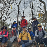
첫댓글 전라도에서도 배타고 섬산행하셨네요.수고많았습니다
먼길 다녀 오셨네예
운무로 인한 바다 조망이 아쉬웁 겠습니다...^^